Have you ever played Geoguessr? It’s a game using Google Street View, where you’re dropped into a random location and have to work out where it is. A few years ago, I found myself looking at this place
and I turned around to find a field bordered by stone walls and thought “I need to go here.” Here turned out to be Birsay on Orkney. It took a few years but here I am on Orkney (which is beautiful and wonderful and I love it) but getting to Birsay seemed a little less likely.
You see, Birsay is at the far east of Mainland (the big central island) and buses are like 4 hours apart, and the main people come for is the Brough. It’s a tidal island, so it can only be visited around low tide and when I checked the tides times for this week, it was about 3.30 pm on Monday and quickly getting later each day after, which meant if I was going to get there, it had to be on Monday except… Well, let’s go back to Monday morning.
The two big tourist attractions on Orkney are Skare Brae and Maeshowe, or the area around Maeshow really. When I arrived I booked a ticket to Maeshow on Monday morning, before I’d checked the tide times but on checking distances and buses, if I was careful, I could do this area and get to the only bus that would get me to Birsay on time.
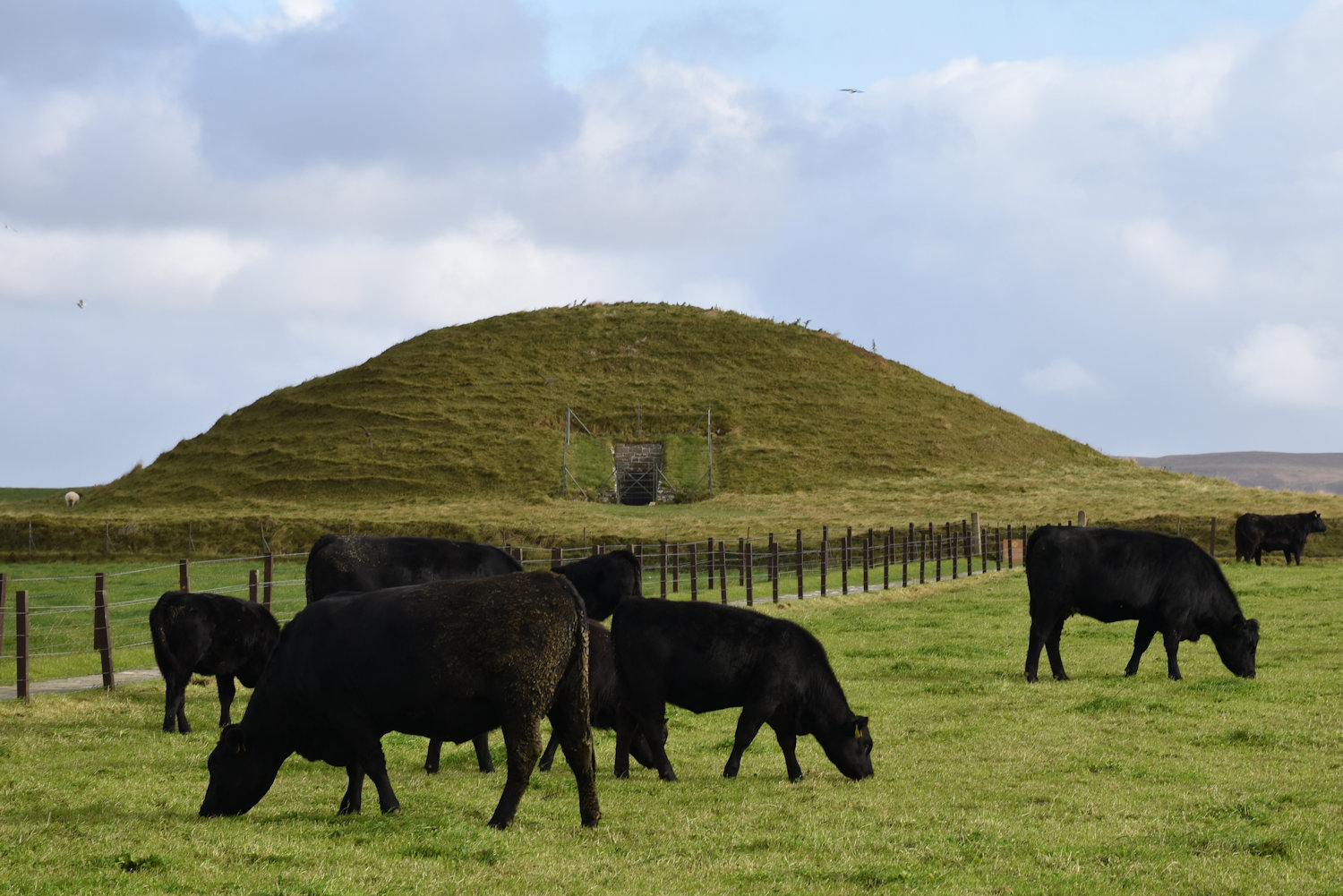
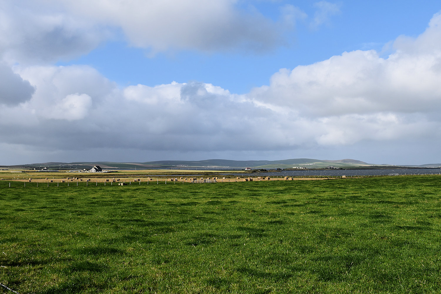
So that’s Maeshowe behind the cows.
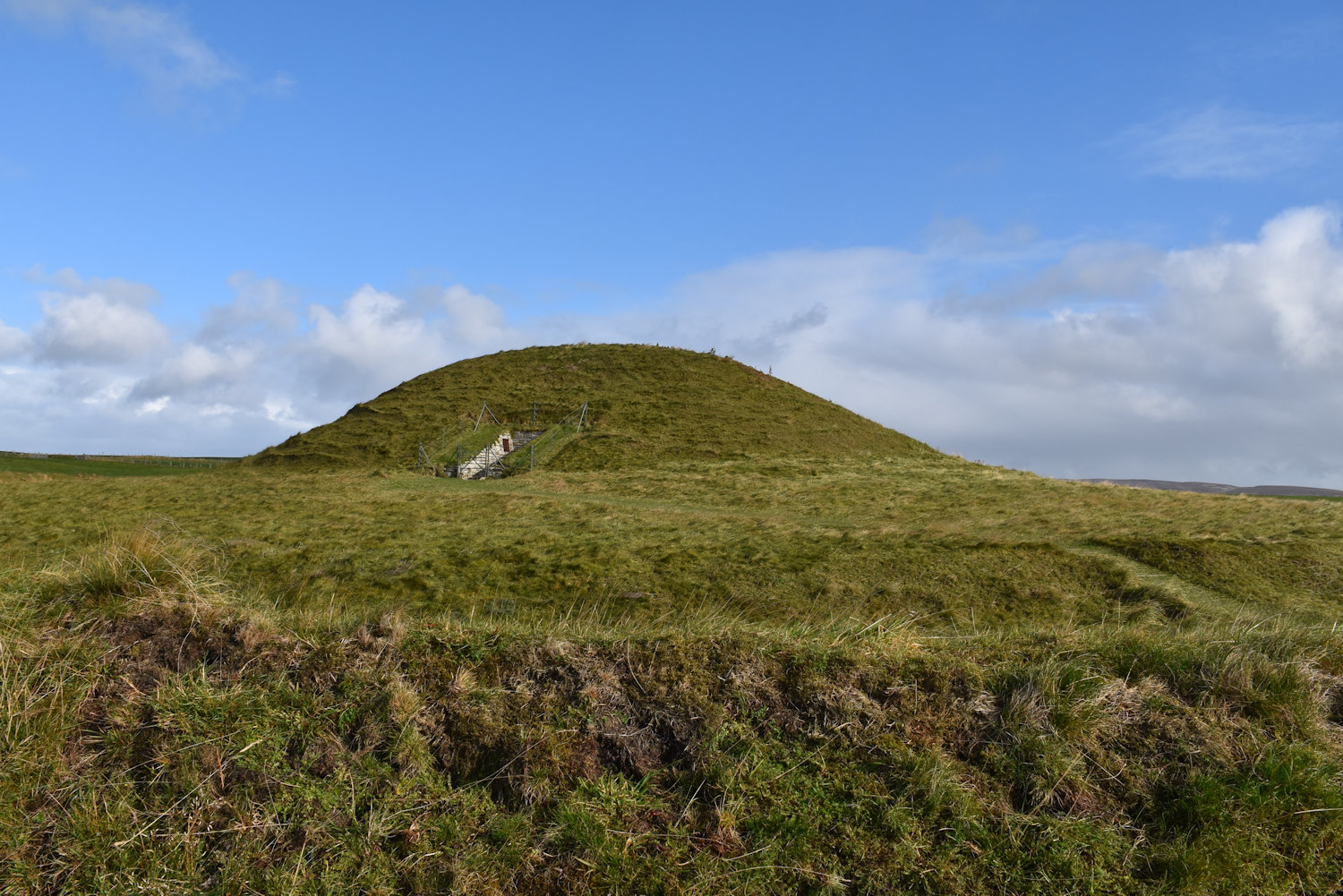
It has a henge (a circular ditch and bank enclosing it, incidentally Stonehenge does not have a henge) but it’s hard to see in photos
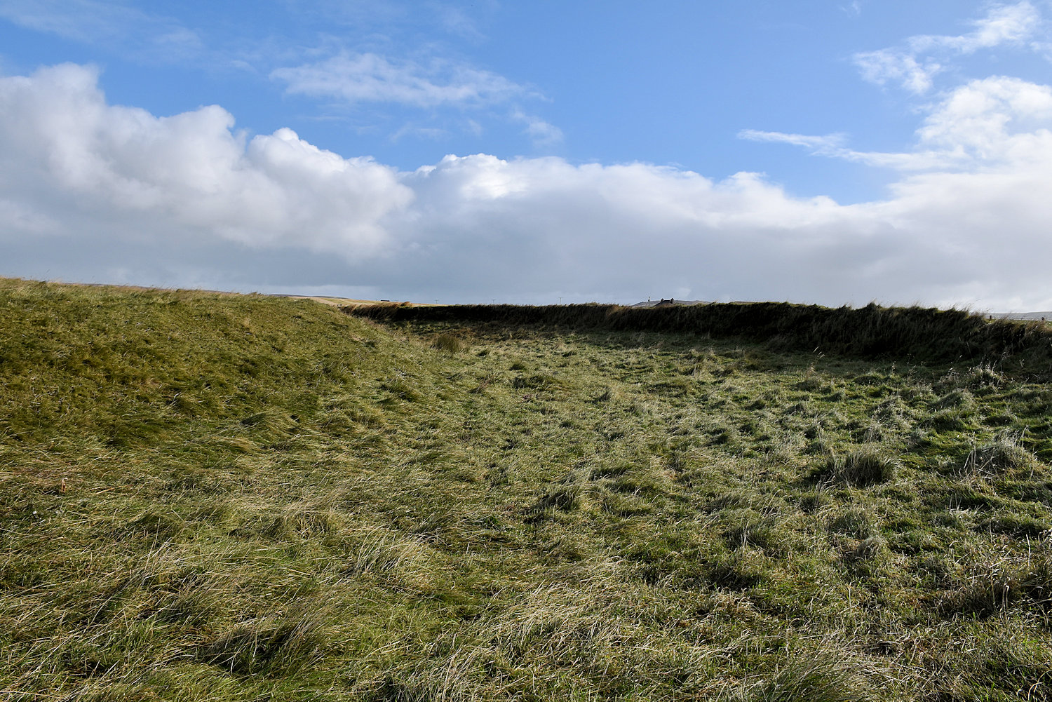
unless you’re down in it.
So Maeshow is a chambered cairn, that is a large tomb, built about 5000 years ago. Unfortunately, to visit you have to do it as a tour. You go to the visitor centre, hop on a bus, go down the road to car park, cross the highway and walk up between some cow paddocks. The entrance passageway is low, but you only need to crouch and inside, well it’s interesting. There’s a large central room with stepped walls, and a chamber on each side. But you’re in there with about twenty other people, with electric lighting and barriers keeping people away from the walls. It sort of lacks the atmosphere of something like the Cuween Hill cairn. Although without the crawling and mud.
What is does have is Norse/Viking graffiti all over the walls. Some from late eras-Vking raiders who took shelter there during a snow storm (I think they were on their way to kill an earl but missed him) and some from later crusades (I think there was an earl with them. His cook/housekeeper was. So many earls.) Also, around the winter solstice, the sun shines along the entrance passage and hits the rear wall. (Possibly they say that to encourage people to come to Orkney in winter, but I do have a postcard showing it.)
Over there is more of the Heart of Neolithic Orkney World Heritage Site (which includes Maeshowe)

Can you see my next stop? It’s there!
OK my next stop was back to the visitor’s centre. Then I had walk back along the highway and up another road in the wind, with rain threatening. And I’m thinking why am I doing this just to look at some stones. Then I saw the stones.
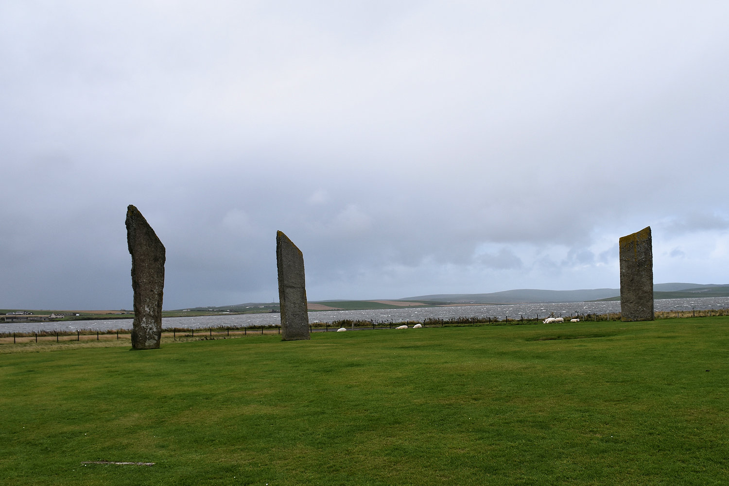
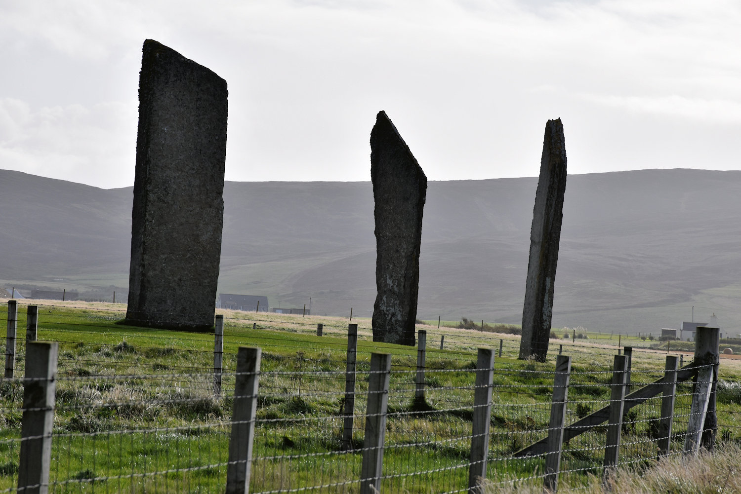
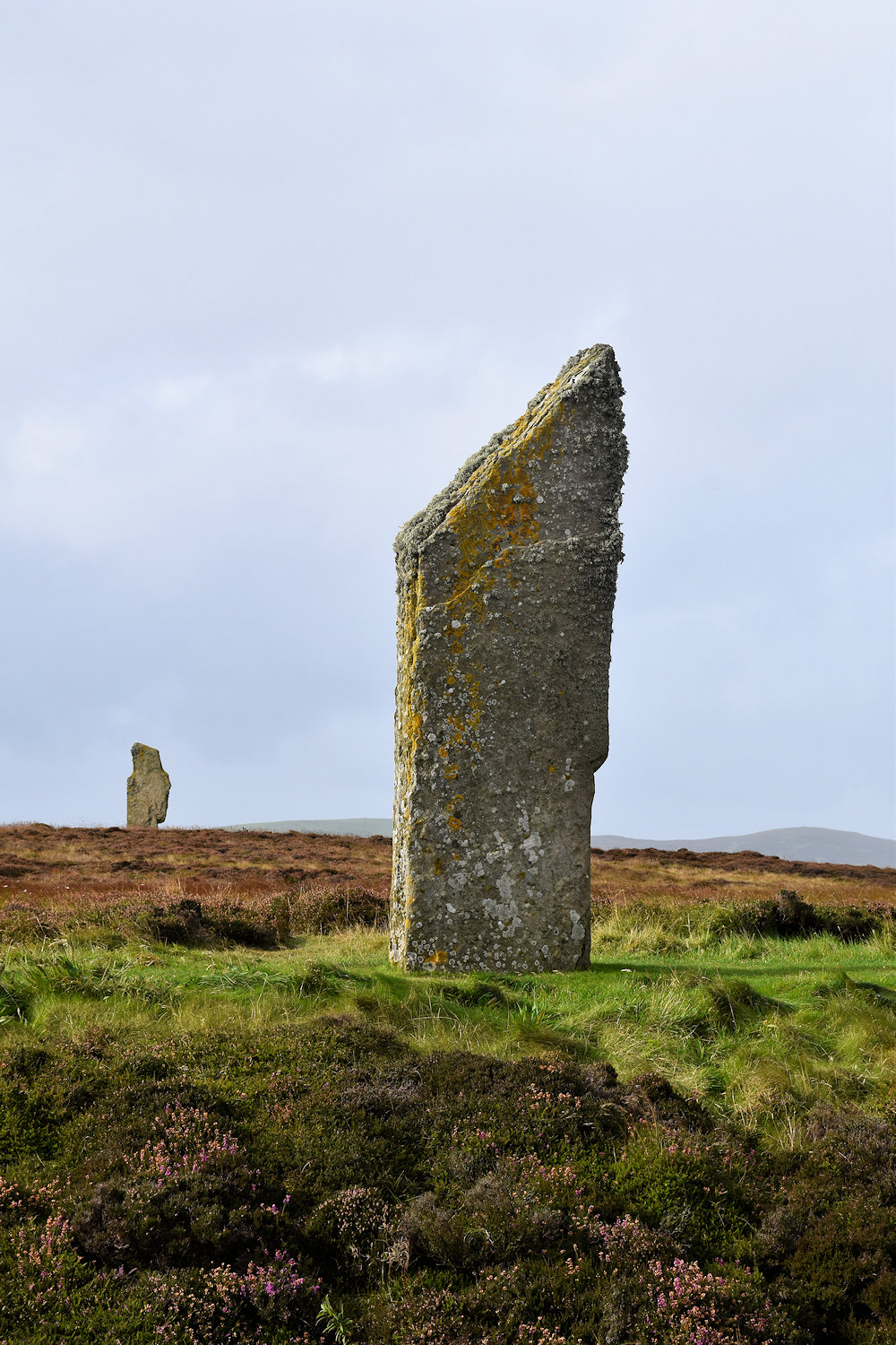
They are lovely and wonderful and beautiful. The Stones of Stenness, once part of a circle but most of it has been lost along with their henge. The nearby panel says in 1814 the farmer, tired of having to plough around them, pulled down on stone and destroyed another before he was stopped. The locals weren’t very happy about that. They tried to burn his house down, twice.
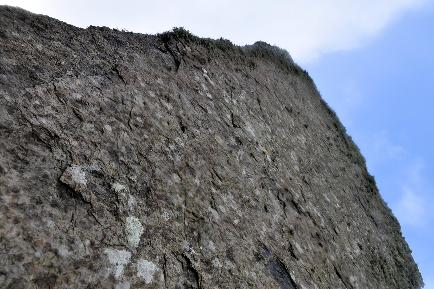
Unfortunately, photos just can’t capture their loveliness. I tried to show how tall one was but the weather wasn’t cooperating.
But just because photos don’t show their true loveliness, I am still going to share every photo I took! No, I won’t because there were a lot of duplicates as I was trying to get the best light.
The Stones of Stenness may be the earliest henge monument in the British Isles, built about 5,400 years ago. Their function is unclear, but our best guess is that they were involved in activities and ceremonies celebrating the relationship between living and past communities.
Historic Environment Scotland

Just over the back is a Neolithic (Stone Age) village. There’s a few in the area.
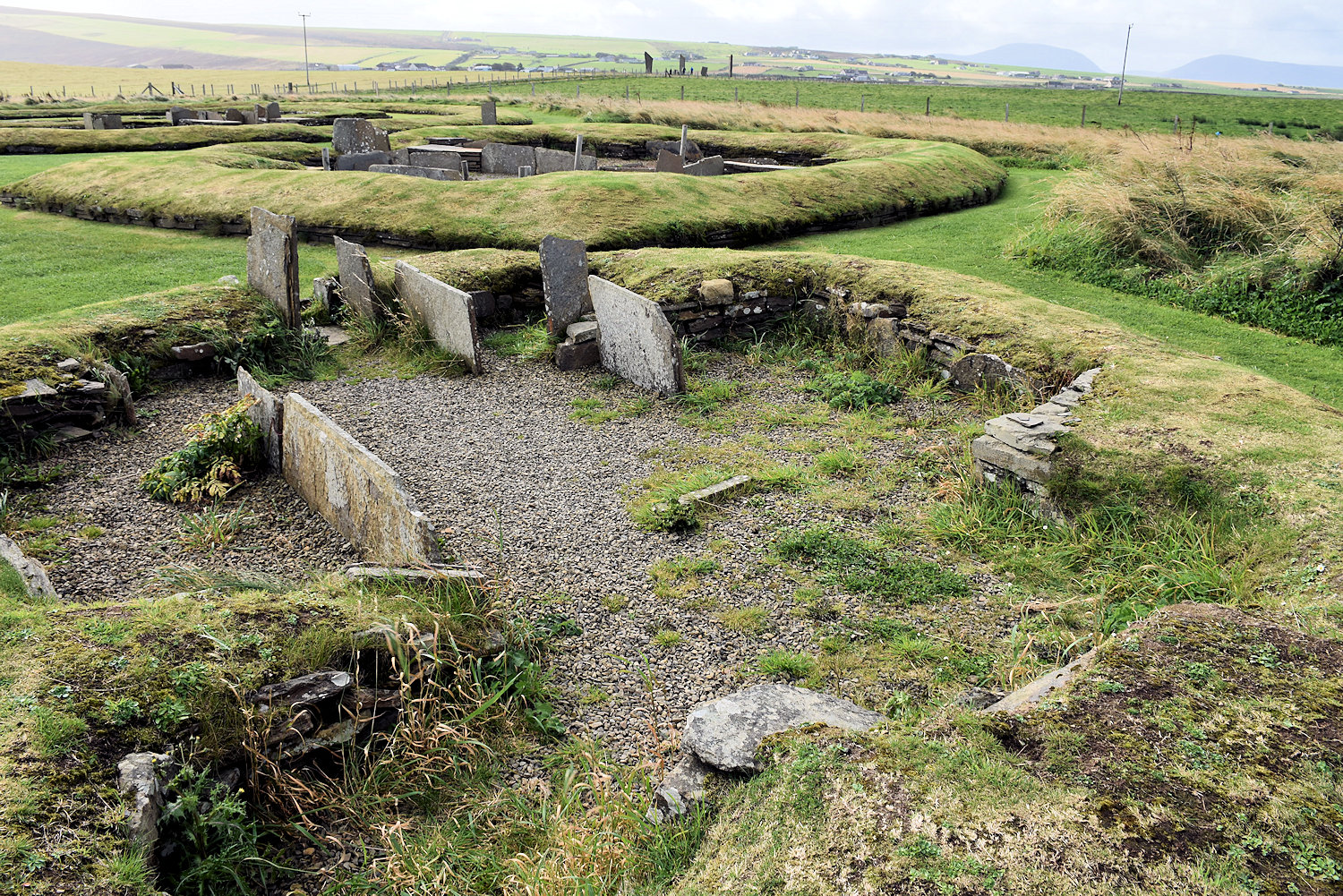
Barnhouse was discovered in 1984. The walls have been reconstructed to give an idea of the layout of the buildings
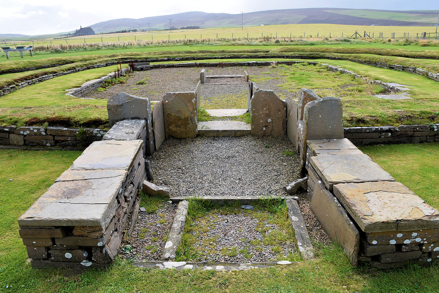
After Barnhouse ceased to be occupied, another structure was added, partially on top of the earlier building plans. This building (known as Structure 8) had a room about 7 m (23 ft) square with walls 3 m (10 ft) thick and an entrance facing towards the north west so that the midsummer sunset shines along the passageway, with similarities to some chambered cairns. The structure was surrounded by a clay platform. The entrance through this was aligned with Maeshowe. The structure is assumed to have served as a ceremonial site rather than as a dwelling.
Wikipedia
The construction of Structure Eight seems to indicate a change in religious and ritual practices of the time. Where once the ceremonies took place within the stone circles, open to the entire community, by the time Structure Eight was built things seem to have changed. The rituals and religious ceremonies now took place in an enclosed space that was accessible to a select few. It has also been pointed out that the design of Structure Eight closely follows the layout of the Standing Stones o’ Stenness. So were the builders of Structure Eight trying to recreate the sacred space of their predecessors but in way that would suit the changing beliefs of the time?
Orkneyjar

🙂
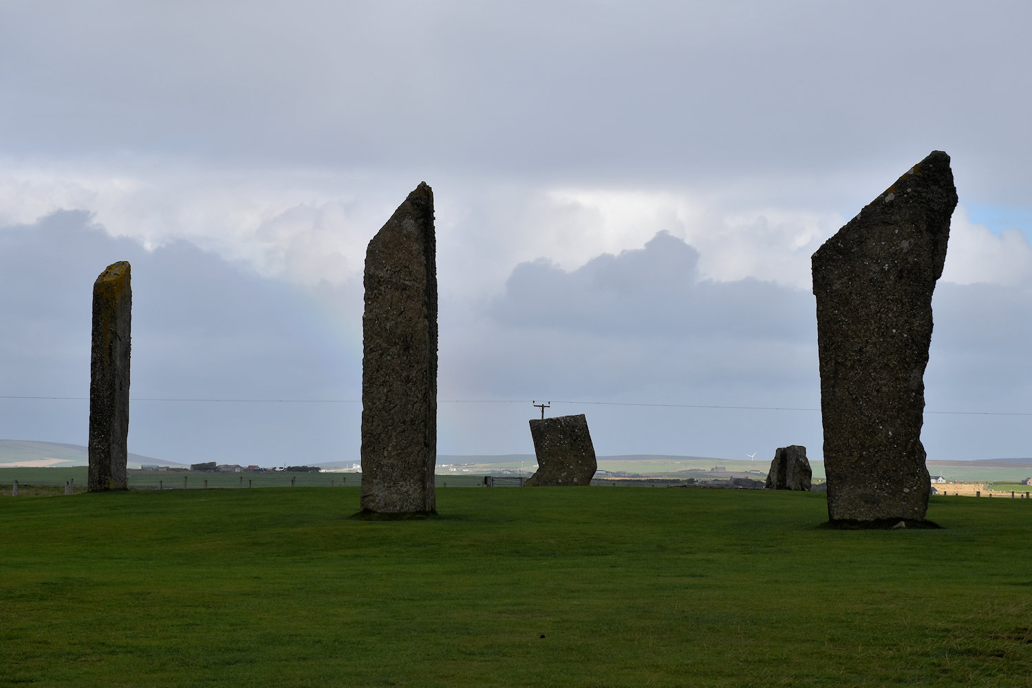
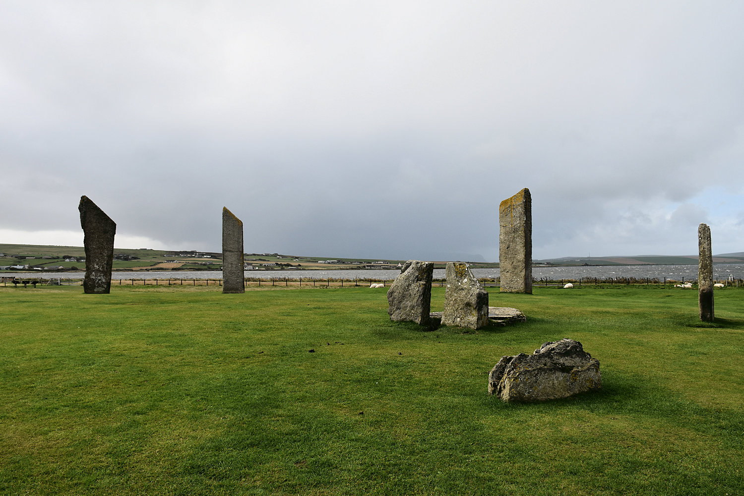
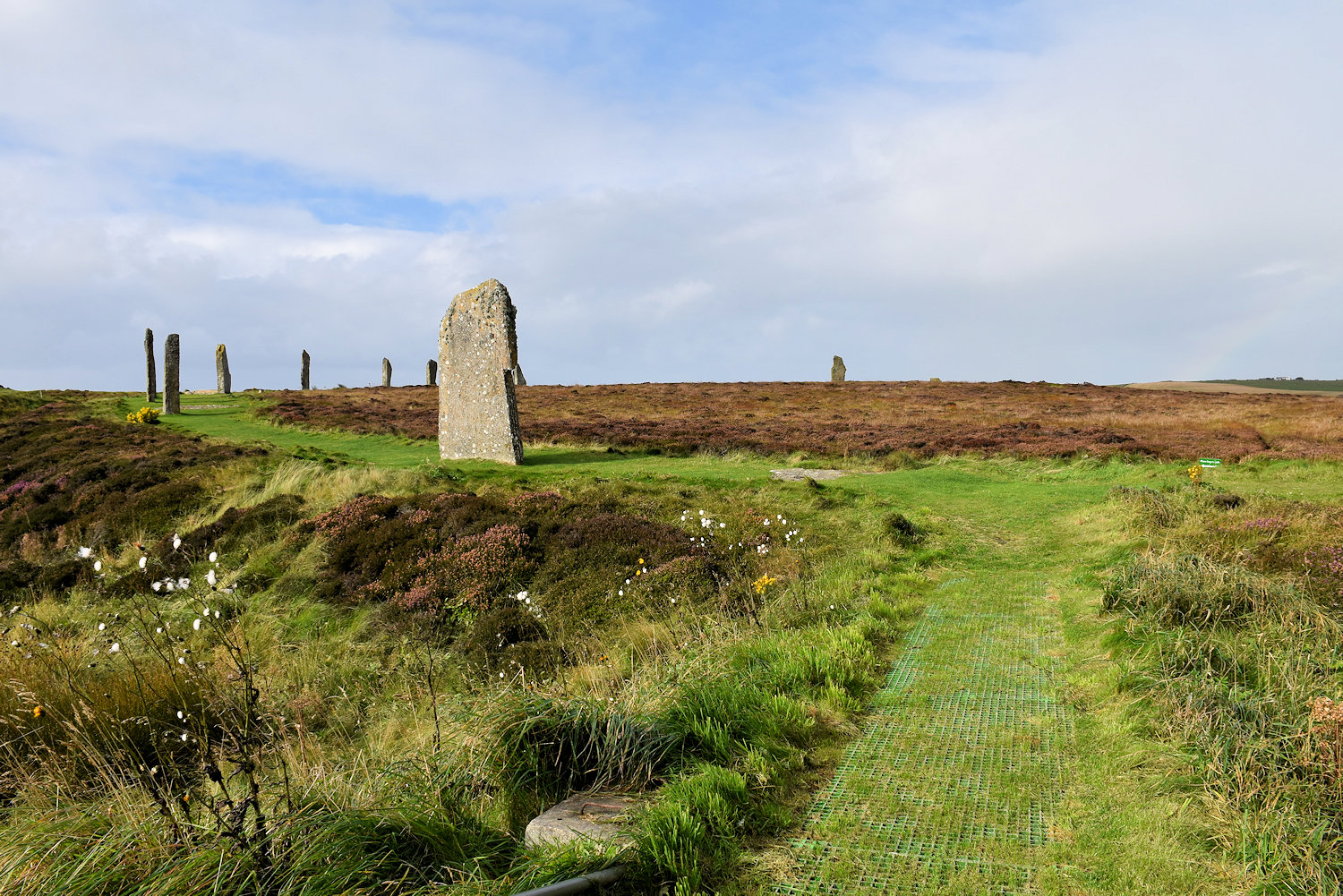
OK there is something that is almost as cool as the Stenness standing stones and that is ring of standing stones.
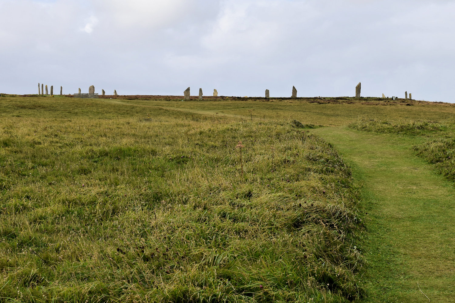
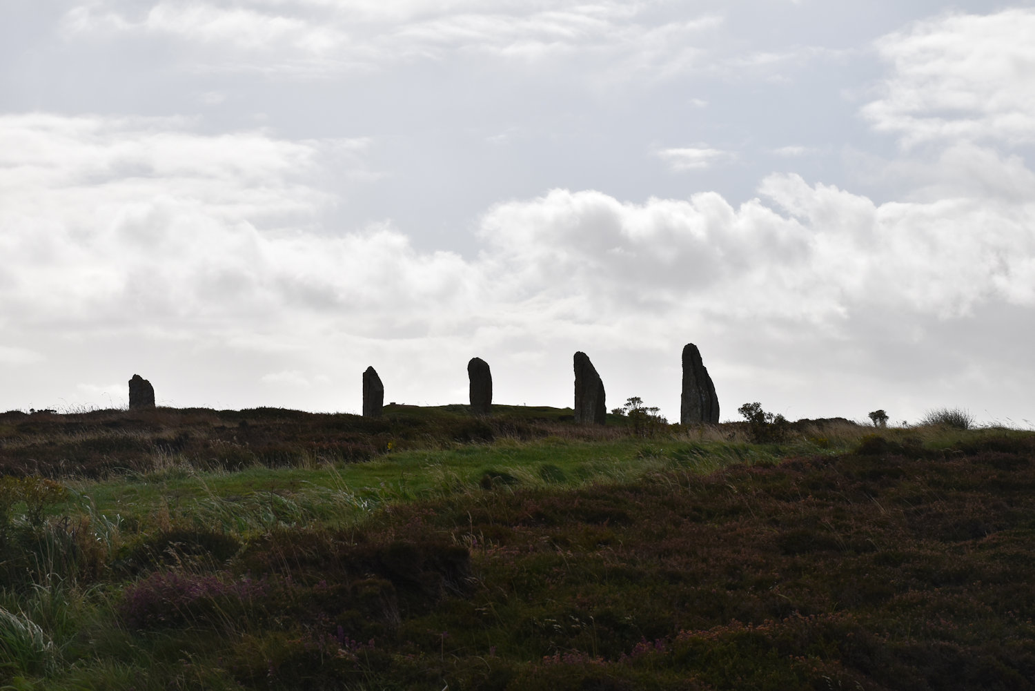
The Ring of Brodgar.
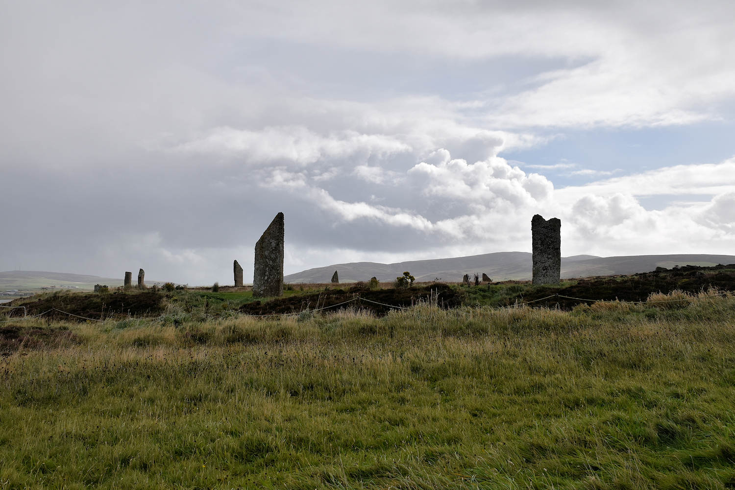
Built about 2600-2400 BCE. Unusually, the ring has a truly circular layout. Of the original 60 stones, 36 survive, ranging between 2.1m to 4.7m tall. The stone circle has a diameter of 104m, and is encircled by a rock-cut ditch, or henge, measuring 136m across, making it one of the largest and finest stone circles in the British isles.
Historic Environment Scotland
It’s a bit hard to show it all at once. So here is the left side.

And here is the right. I did make a panorama, but it’s better for showing how windy it was by then.
On leaving the stones, with a bit of luck, I was able to get back to Kirkwall in time to get some lunch and catch the bus to Birsay. Less fortunately, the weather continued to deteriorate.
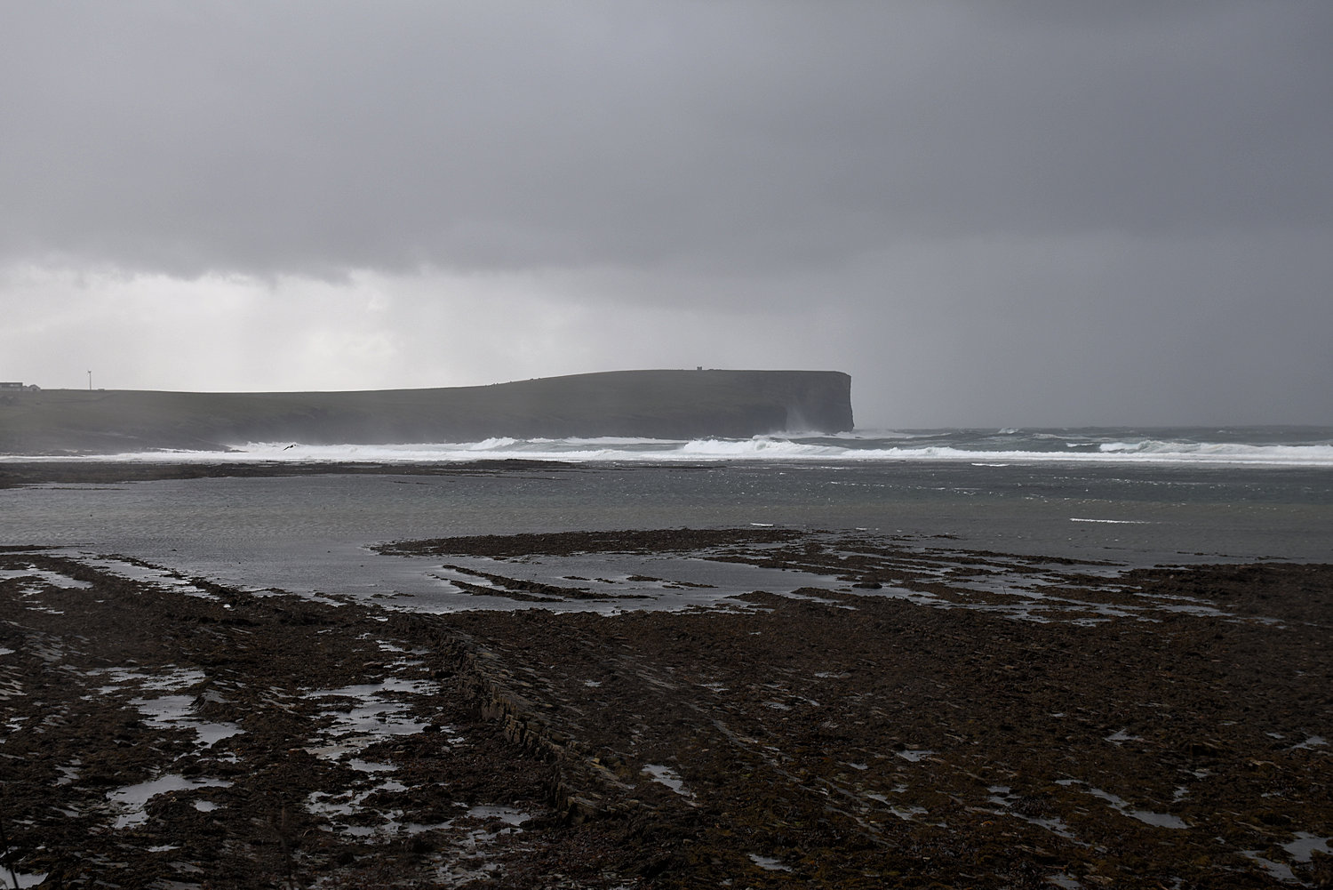
It’s hard to show you how bad the weather was because it wasn’t good weather for taking photos. My big camera has a raincoat but the lens is exposed and gets rained on. I wipe it down. It gets wet again.
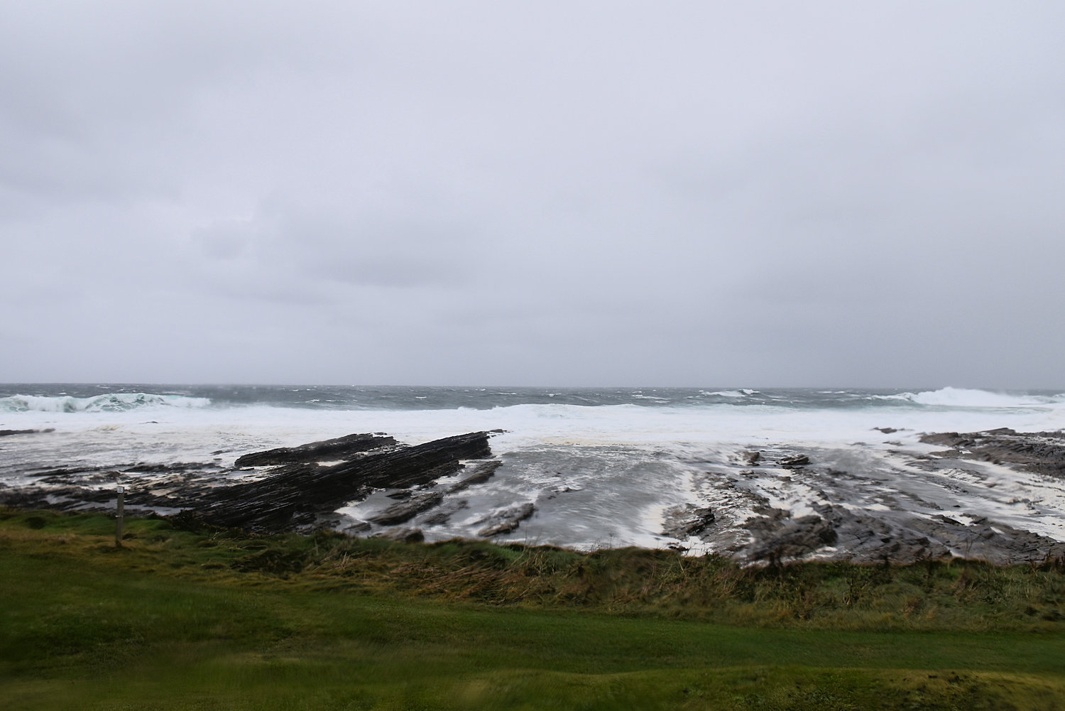
With the rough sea and the wind blowing a gale (literally), I knew there was no way I’d get across to the island, but I did want to walk up to the carpark to have a look across, despite the wind and sleet.
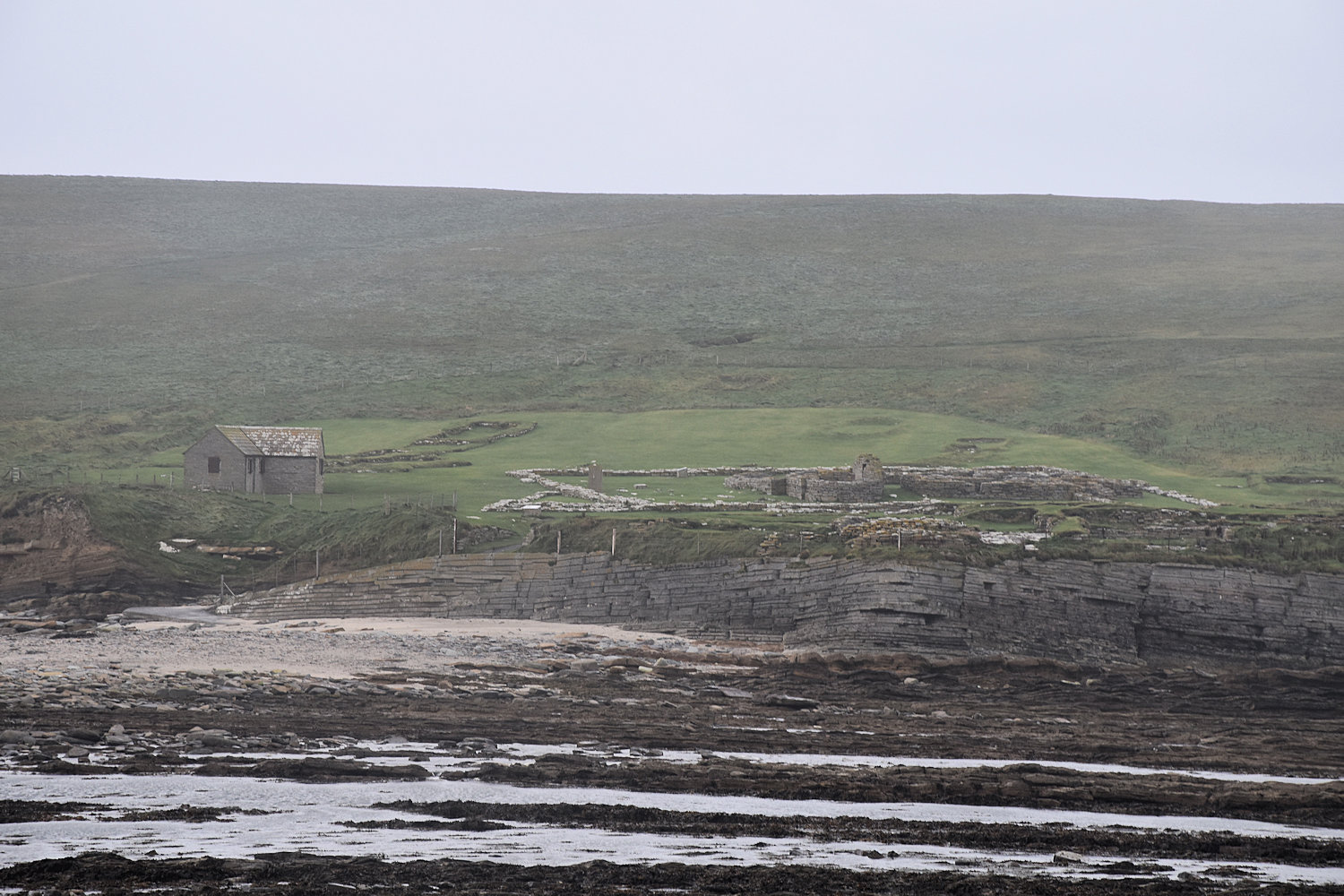
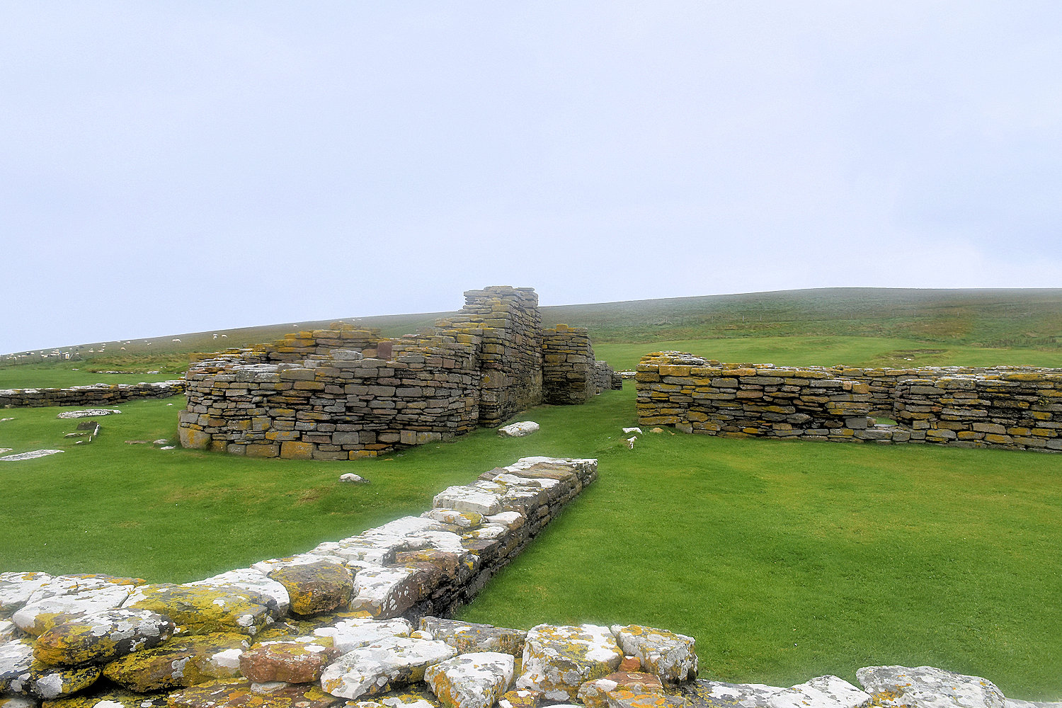
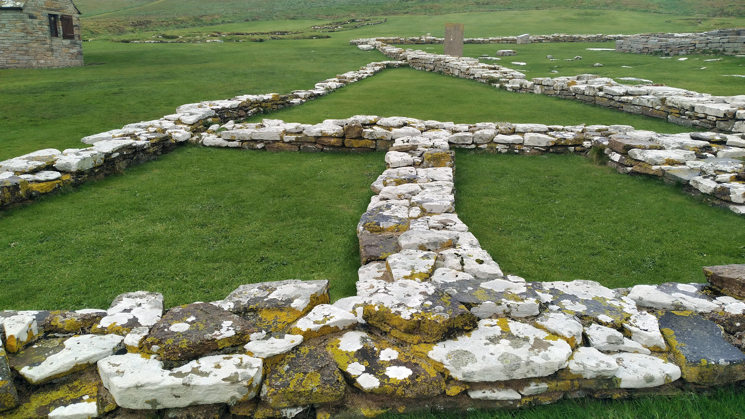
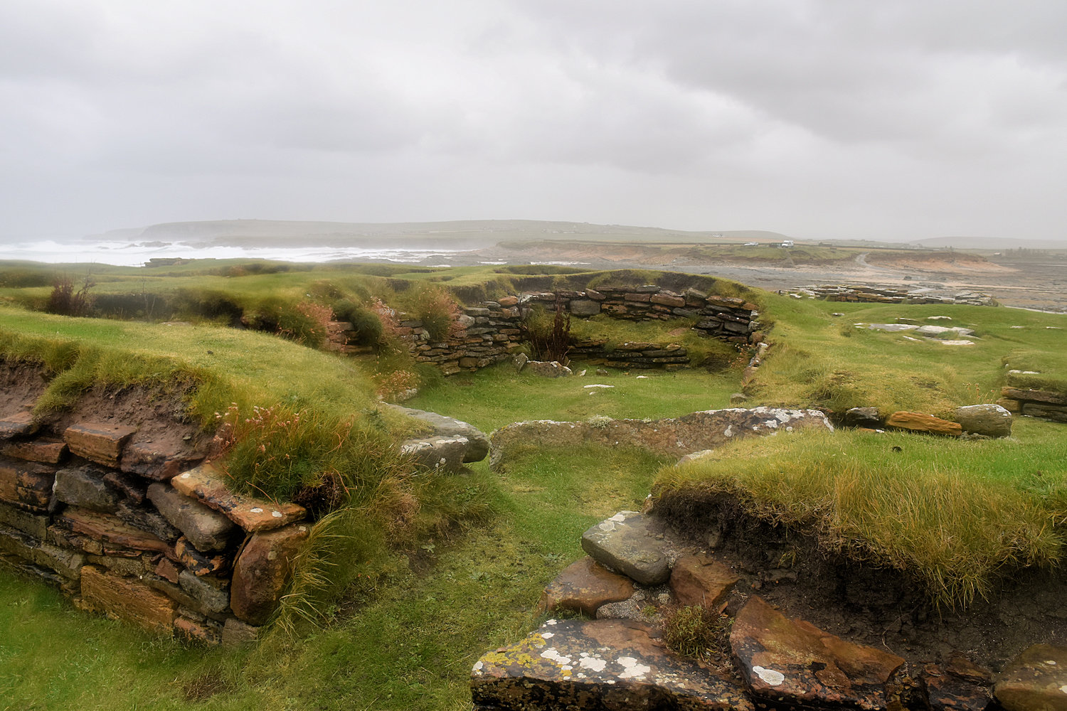
So that’s the Brough of Birsay. There was a Pictish settlement there (back in the time of the Romans, the Iron Age tribes in the north became a bit nervous so they banded together to form a kingdom, the Picts), then came the Norse, who left the remains you see now. At the back are some long houses and at the front a small Norse settlement. In the middle, surrounded by white walls, are a 12th century church and churchyard. Birsay was important settlement at the time, home to the earls (of course).
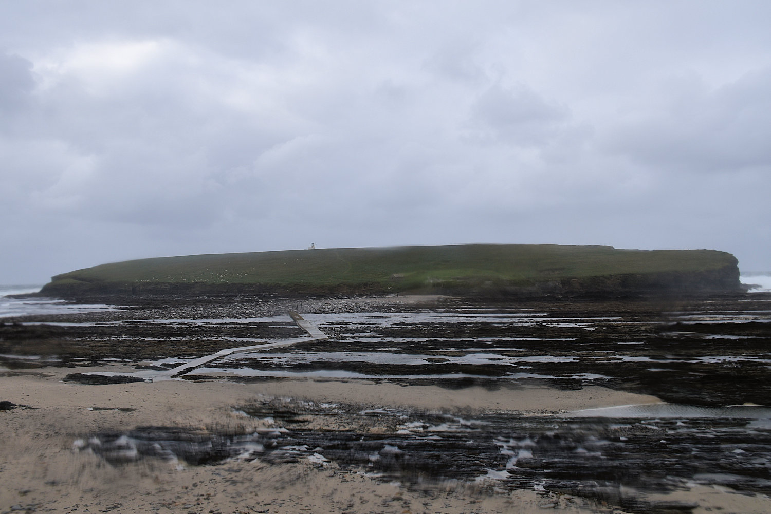
That’s the causeway. As the tide is almost out, there is no rough sea, and there are some people coming back across. I considered the matter. Then climbed down the stairs to the beach.
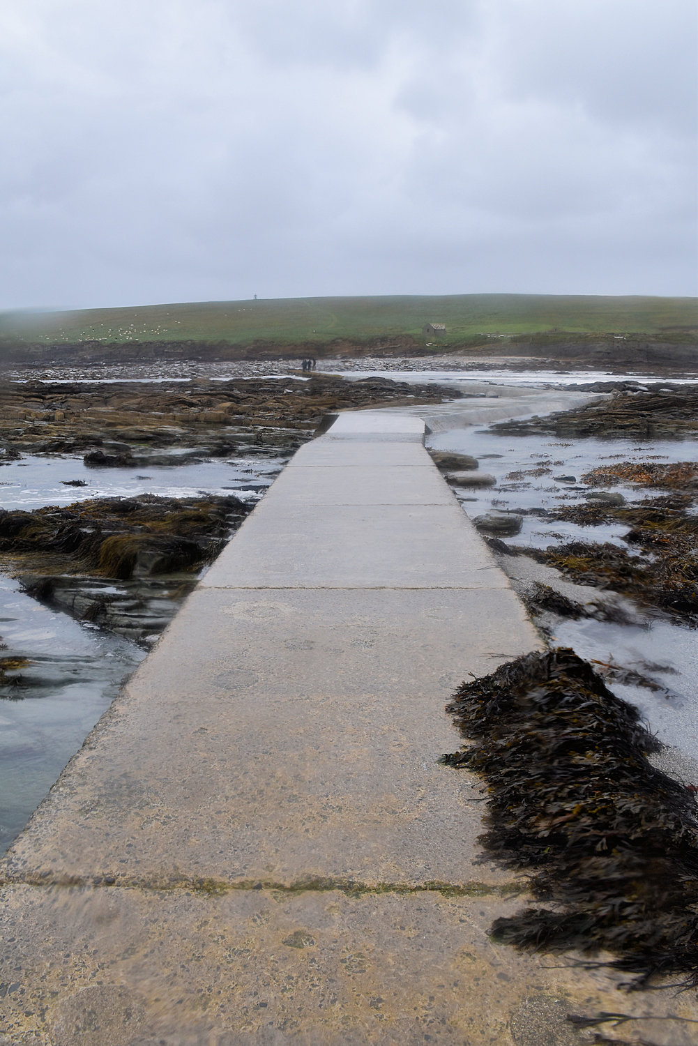
Being sheltered, the wind is nowhere near as bad as above. It’s still raining of course. So the first part of the causeway crosses the beach on this side.
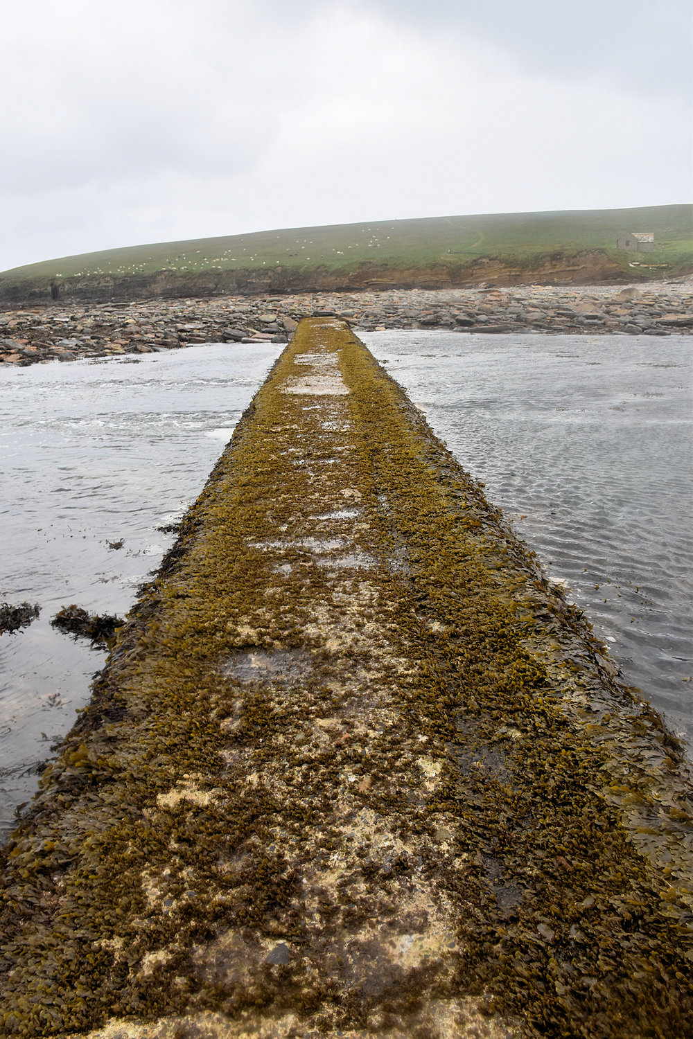
This is the interesting part. It’s not as slipper as it looks. It couldn’t be, as no one would be able to cross.
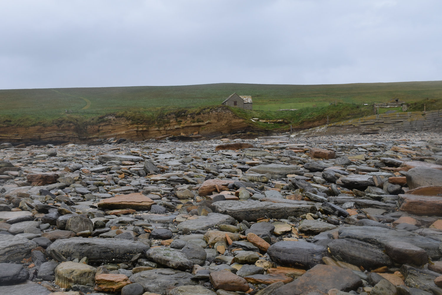
The final part is the hardest, across a rocky beach.
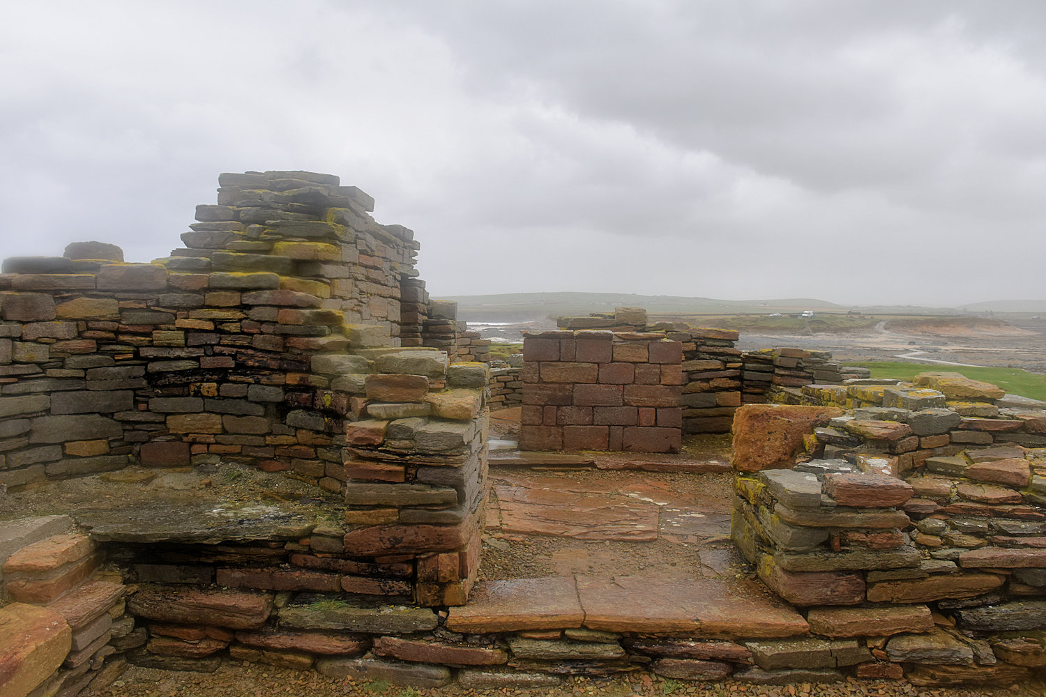
So, here is the Brough of Birsay. This is the church and surrounding yard. Unfortunately with the rain wiping the camera lens was a waste of time. I tried, but the photos are a bit fuzzy.
I did accidentally take a photo with the phone so you can see what it should look like. I also have a panorama (but remember it is very wet and windy).
There’s the church.
And the Norse houses

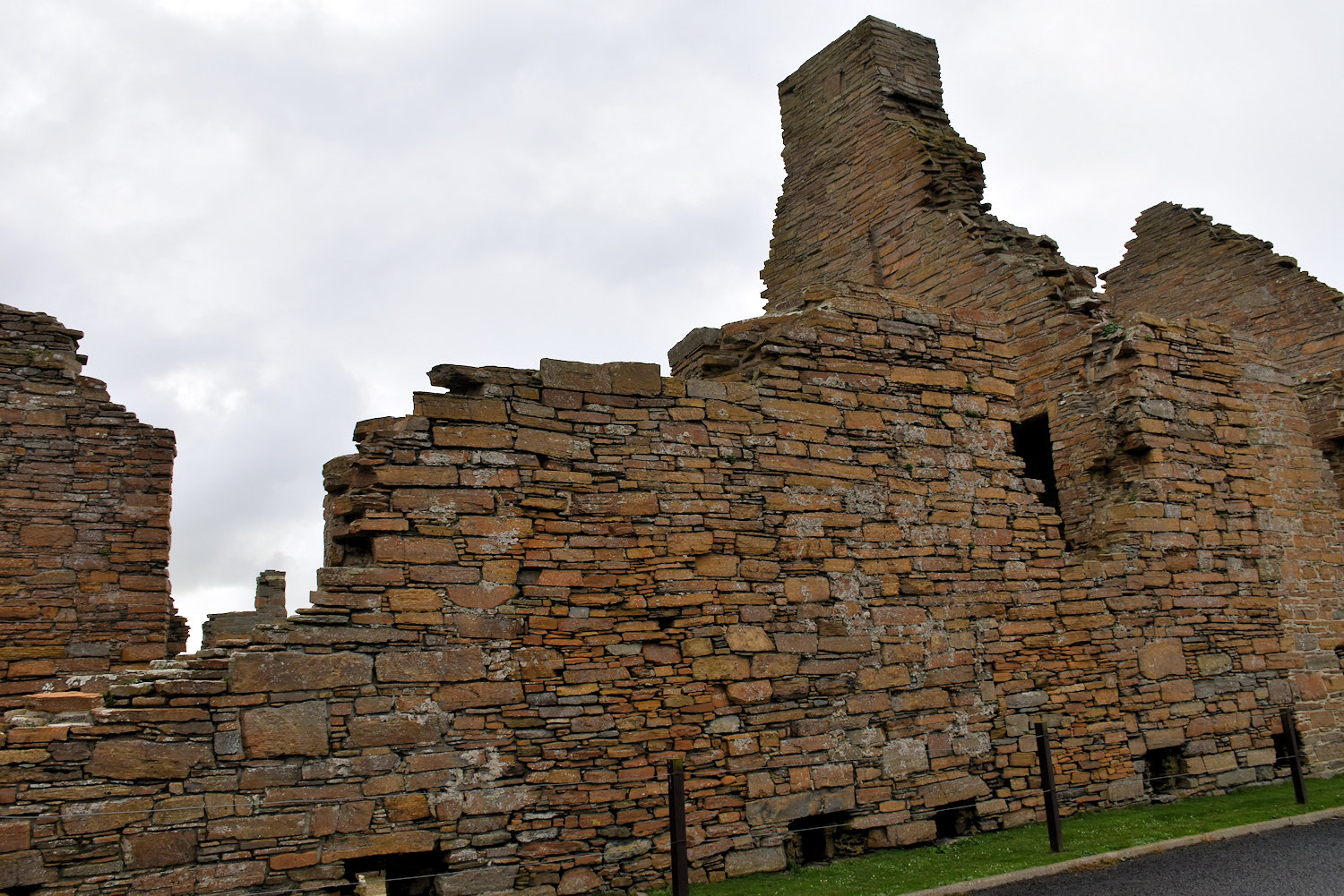
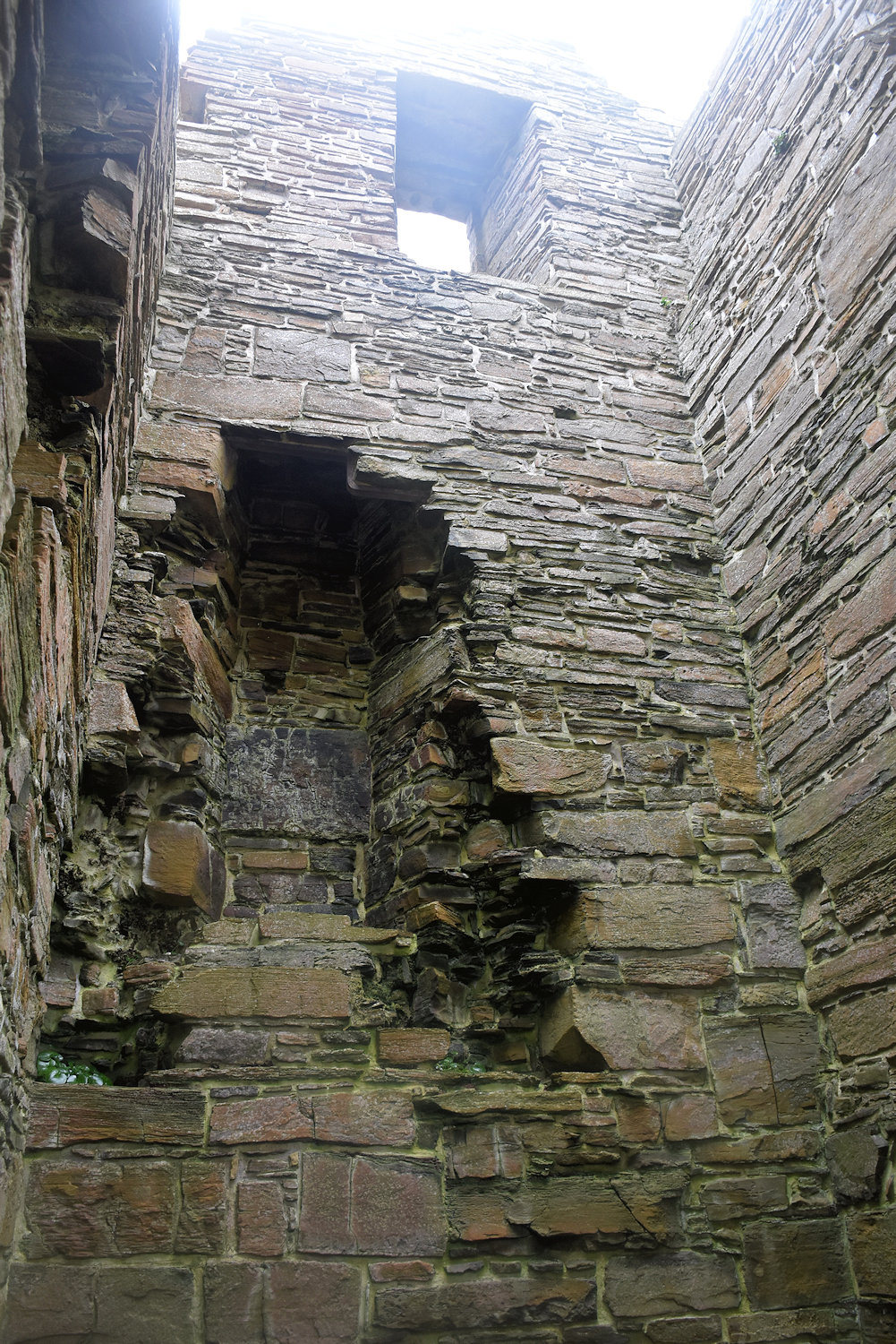
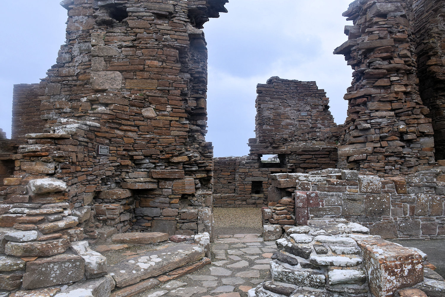
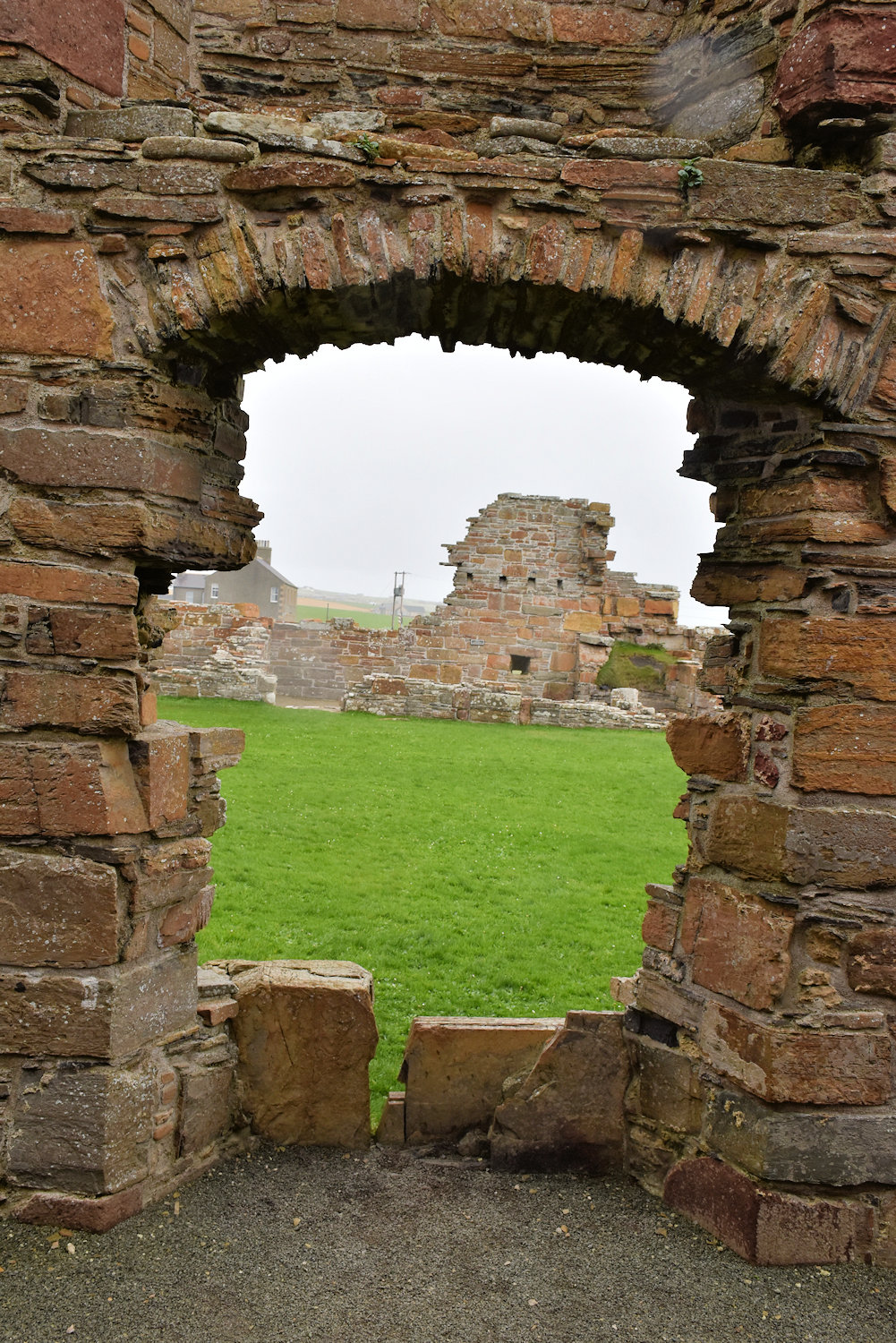
Once I was back on the mainland, I walked back to the Earl’s Palace. Another earl’s palace, yes. This one was built for Robert Steward, father of the guy from Kirkwall and Scalloway. He was generally hated and despised, but not as much as his son.
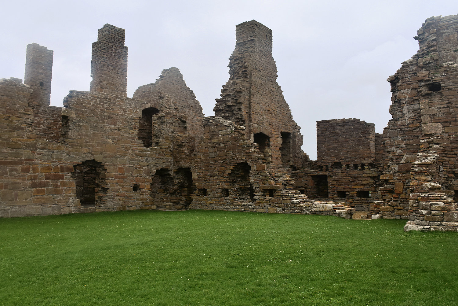
This one was built around a courtyard. Rather than showing you twenty photos of the site, have a look here.
The rain had lessened but was still a problem (wipes camera down again). It does make for interesting effects.
Finally, to finish off, some more photos of the palace, because of the trouble involved in getting here to take them.

🙂


