West Kennet Long Barrow

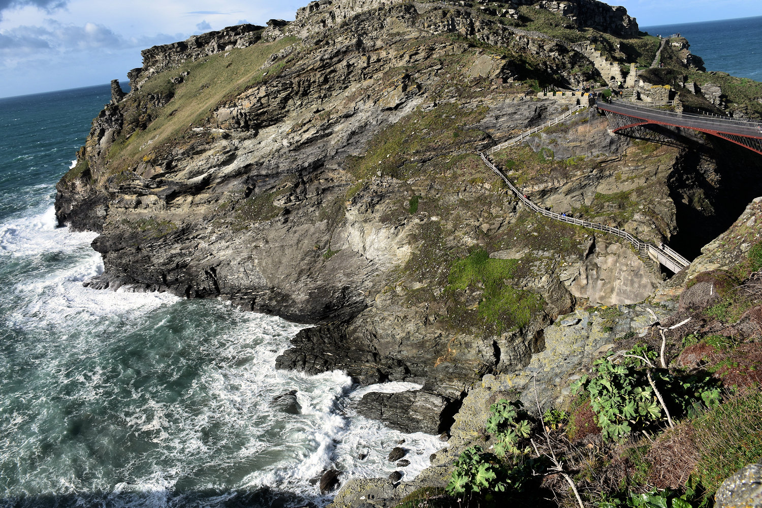
This is another Neolithic chambered tomb, near Avebury. It’s significantly bigger that most of them. High enough in the open bit to walk around in (as you’ll see below). It’s also one of the oldest tombs. Actually, the List of oldest known surviving buildings on Wikipedia has it as the second oldest building in the UK (after the Knap of Howar) and the oldest in England (and older than Stonehenge & the Egyptian pyramids and everything else you’ve heard of probably). Which I didn’t realise at the time because I went to Avebury for a day trip and bought booked train tickets so I’d have about 2-3 hours in the village and therefore wouldn’t want to walk out to look at the barrow. Right…

Anyway, the panel at the site says: The long barrow was built in about 3650 BC by an early farming community, people who had arrived from Continental Europe only a few generations before. For about 50 years, they placed their dead into the different chambers, grouping them according to age, sex and perhaps social or family group. As new people were placed in the chambers, older burials were disturbed and the bones re-arranged. Over the next 1,000 years people regularly returned the long barrow, filling the chambers with earth, ash, chalk rubble and sarsen stones. Mixed with this material were pottery sherds, flint tools, and the bones of both humans and animals. Perhaps the barrow became a shrine to the ancestors or to the land itself. In the early Bronze Age, three large stones were placed to block the entrance and finally seal off the chambers.

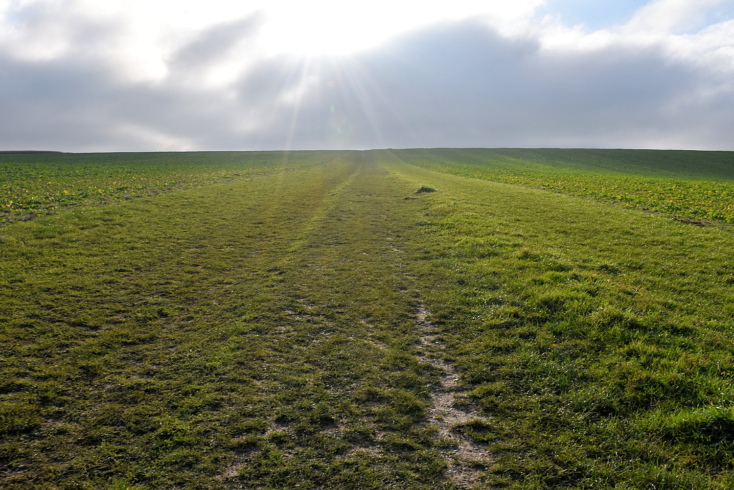
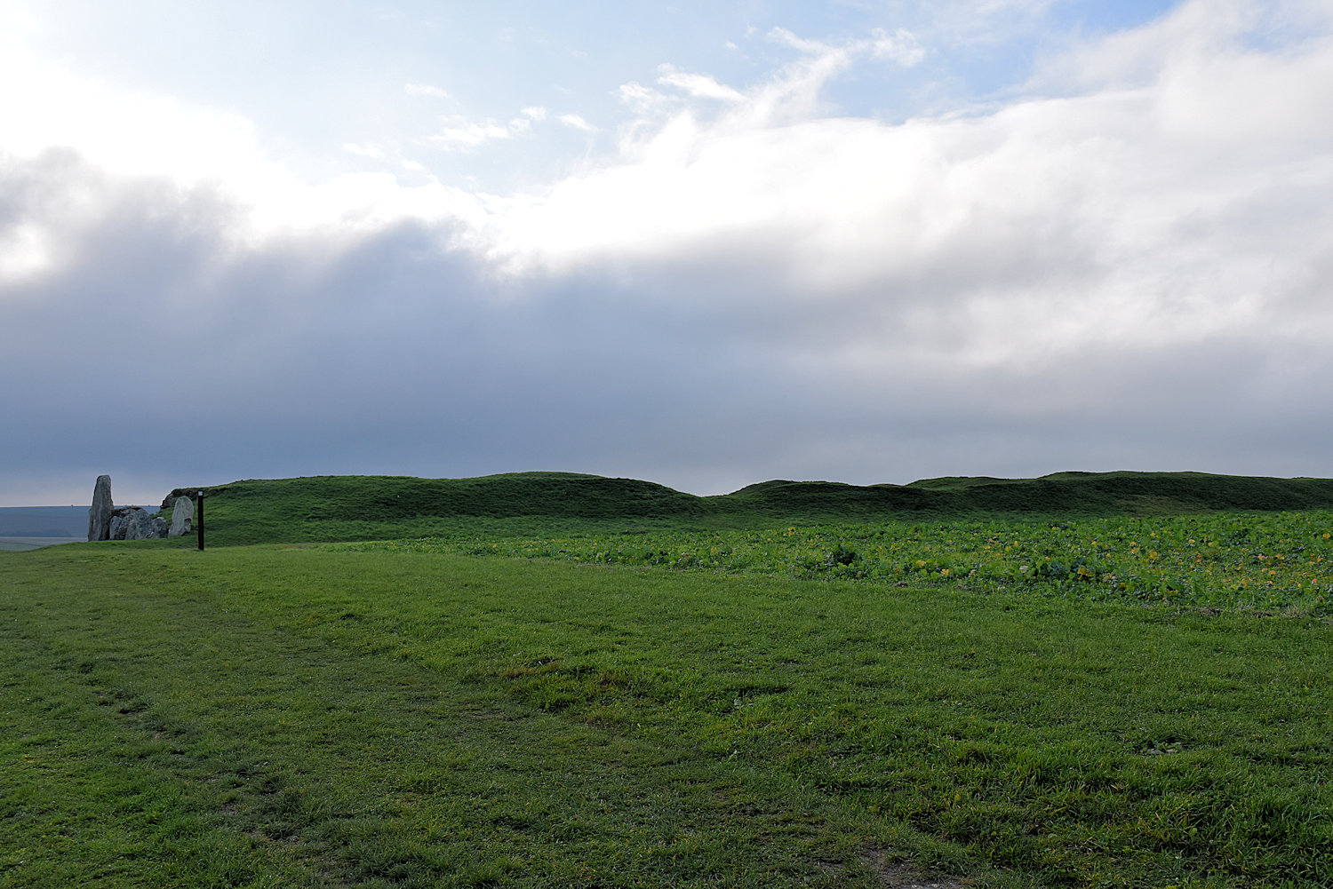
The barrow is at the top of a hill. (You can maybe just see it if you click to get the large picture.) (You did know you can get larger pictures by clicking?) It is very long, about one hundred metres. Too long for the camera once it become close enough to see properly.

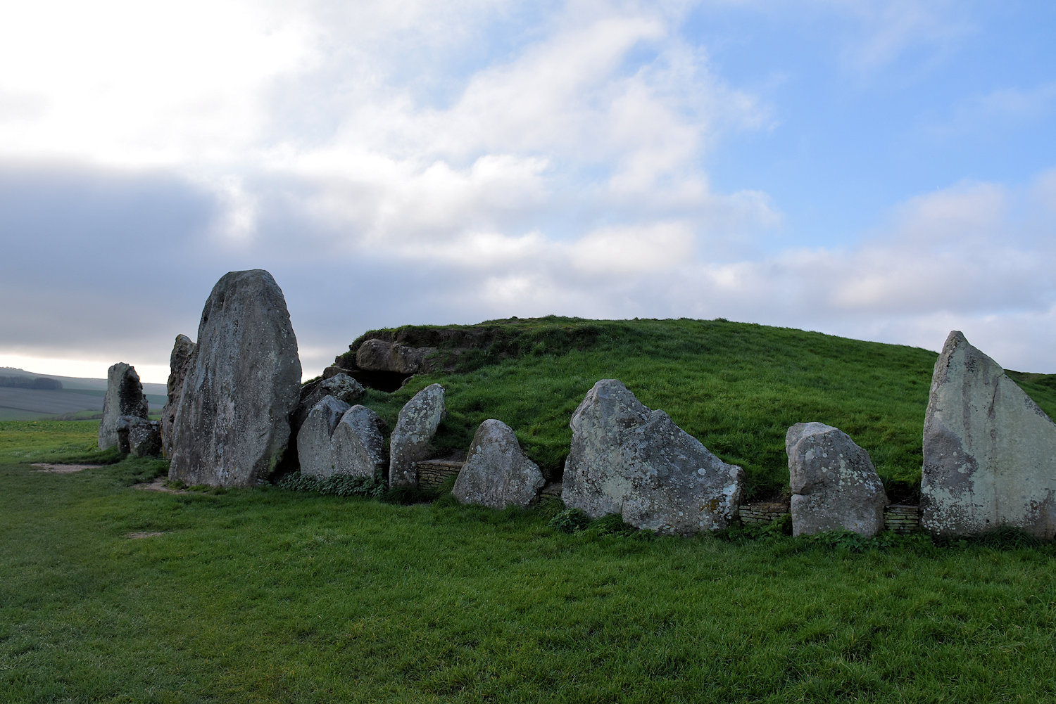
Some cremations and the partial remains of at least forty-six individuals – both male and female and of all ages – have been found inside, together with grave goods including pottery, beads and stone implements such as a dagger, dated to between 3000 and 2600 BC. The tomb was closed sometime around 2000 BC and the main passage filled with earth, stones, rubble and debris. The forecourt was then blocked with sarsen boulders and a false entrance of twin sarsen uprights constructed. Finally, three massive sarsen blocking-stones were erected across the front (eastern end) of the tomb.
English Heritage

For comparison, the Averbury henge and stone circles were constructed about 2850-2200 BCE. So not built by the same people and not even used by the same people. The infilling seems to have started before or about the same time as the henge constrction started, and not that long after that was finished, the barrow was sealed. Burial barrows are just so last millenium. Or maybe the kids kept sneaking off to have parties in there, or cows were getting lost.

Read more

Glastonbury Abbey

I loved this place. It was full of interesting things to look at and also good for just sitting quietly. I went first thing in the morning. There were maybe a dozen other people there, but as it’s a big site (there’s some gardens off to the side), it felt more deserted than crowded. As the entry ticket lets you come and go throughout the day, I went back just before the last entry and stayed until closing.

The first thing you see on entry is the Lady Chapel.

The monastery that was here dates back to Saxon times, the 7th or 8th century, and there was a church here before that. It was an important–and influential–institution in Medieval Christian England.

But in 1184 there was big fire that burnt down many of the monastery’s buildings, and the old church as well. As a replacement, the monks wanted to build a great church but they ran out of money. Then they discovered the tomb of King Arthur and his second wife! Which brough pilgrims (and money). Who says God doesn’t perform miracles.

(That is what happened.) (Also maybe some political stuff going on.) (And I want to know about his first wife.)

The ruins of the great church, but that’s not the entry to the church. Where I’m standing is the nave (what you might think of as the body of the church, where people sit). The arches are the entry to the choir (or quire).

Read more

Glastonbury

One of my favourite parts of travelling is that moment when the plane comes out of the clouds, the bus turns into the main street, you step out of the train station and see for the first time where you’re going to be for the next few days. Sometimes I think “You’re lovely.” Sometimes I think “Meh”. And once I thought “Now this looks fun.” That one? Glastonbury, where Christian meets pagan, and the results is… interesting.

So let’s start with the Tor, because I did. Climbing up the many steps just before sunset. (300 apparently, more than Bath Abbey Tower! Not as narrow and steep though.) It’s the tower of 14th century church on a hill. It’s also the entry to the land of the bed. The home of a fairy king. Avalon. The resting place of the Holy Grail. The source of two springs, one red, one white. (That one is actually true.)

It does have interesting lighting.

Read more

Just some photos of Bristol

I was only in Bristol I could use it as a base to visit some nearby places so I didn’t have time to look around the city. Although I came back from Caerleon mid-afternoon so I had enogh time to head over to the harbour to have a look over SS Great Britain before the sun set, and the day I left I took some photos around the Old City (where I was staying) and Castle Park.

This is a 1878 steam crane. You can go in and look around it.

Read more

A Visit To Bath

This is Bath, the largest city in Somerset, with a population of about 100,000.

In Georgian times it was very popular as a spa town and a lot of its architecture dates from then.

Not this though. Bath Abbey was built in the late 15th/early 16th century, replacing a much larger Norman cathedral. This building is big, but apparently it would easily fit inside its predecessor. Also, I’m told it should be a priory church not an abbey, but Queen Elizabeth said it was an abbey and so it’s an abbey. It also has no earls buried in it. (I asked, which is why I found out about the priory church thing and also earls generally preferred to be buried on their own land.) There were 3829 other people buried under the floor though. (“Were” because the floor was recently replaced and any remains found were reburied in a nearby cemetery.)

Also, the tower has 212 steps. I know this because just inside the door is a piece of paper that says so. It also has a list warnings and a list of health conditions that if you suffer from you shouldn’t climb up the 212 steps, and next to that another piece of paper that you sign to say you’ve read and accept everything on the first piece of paper.

Read more

On the road: Tintagel to Bristol

I want to write more about Tintagel (there’s some interesting things going on when you start looking) but I need to get to Bristol. This requires catching four buses, with three changeovers. I could have done it in three but there was a town on the route I wanted to around.

The first stop is at Camelford. It’s a small place. Just this main street (and houses, schools, industrial areas etc). As previously noted, it’s a place to change buses. In particular, between bus 95 (which runs along the north coast) and buses to everywhere else in the world.

Read more

St. Nectan’s Glen

St Nectan’s kieve is revered as a sacred place, where numerous ribbons, crystals, photographs, inscriptions, prayers and other devotions now adorn the foliage and rock walls near the waterfall. You will even find a number of small stacks of flat stones, known as Faerie Stacks, constructed from stones collected from the waters by visitors, marking a special thought or moment in time during their visit, or to commemorate memories and loved ones. . . . It is believed that a building (known as the Hermitage) located at the top of the waterfall belonged to the sixth-century Saint Nectan. The date of the building is uncertain but according to legend, Saint Nectan rang a silver bell in times of stormy weather to warn passing ships of the perils of the rocks at the mouth of Rocky Valley. It is also understood that the ruins of a Christian chapel provide the lower part of the walls of a cottage erected in the 1860s, and extended around 1900.
St Nectan’s Glen

The idea that the sixth-century Saint Nectan had his hermitage above the waterfall is myth. According to legend, Nectan rang a silver bell in times of stormy weather to warn shipping of the perils of the rocks at the mouth of the Rocky Valley. Though other legends are also told of Nectan (such as his burial under the riverbed), no evidence exists to substantiate Nectan’s presence here. His home was further north, in what is now Hartland, Devon. The name is first recorded in 1799 as Nathan’s Cave in reference to a local character, either Nathan Williams or Nathan Cock, and the Cornish word Cuva (pronounced keeva) meaning tub.

The legend connecting St Nectan to the falls is the romantic whimsy of the nineteenth century clergyman, Reverend Robert Stephen Hawker who first attributed the falls to the saint in his poem, The Sisters of the Glen in 1846. The “hermitage” written about by Hawker and others was a simple summerhouse and had no connection to any saint. Many of the site’s legends are the result of Hawker’s poetry and the vivid imagination of nineteenth century Trethevy farmer, William Goard who led tour parties to the falls.
Wikipedia.

A Visit to Boscastle

I thought Boscastle was another coastal town with an interesting harbour but instead it’s collection of curious cafes and gift shops with an interesting harbour. I spent a happy hour looking through the shops. (There is a regular town further up the hill.)

Over a century ago Boscastle was a busy, bustling place. It was a commercial port throughout most of the 19th century, for the railway did not reach north Cornwall until 1893. Before that date all heavy goods to and from an area stretching many miles inland had to be carried by sea. More than a dozen ketches and schooners of 30 to 200 tons traded regularly through the little port. In one year alone 200 ships called. Many vessels brought supplies in from South Wales and Bristol but even cargoes of timber direct from Canada came into Boscastle. The tortuous harbour entrance, with the island of Meachard as an extra hazard, meant it was never safe for sailing vessels to enter Boscastle un-assisted. They were therefore towed or ‘hobbled’ in by ‘hobbler’ boats manned by eight oarsmen. Gangs of men on shore took other ropes to keep the ships in the middle of the channel.
National Trust

Postmarked 1906
Publisher: Valentine

Read more

Tintagel

This is Tintagel. Do you know the story?”

Back in about 1135 a guy by the name of Geoffrey of Monmouth wrote a book called “The History of the Kings of Britain” and he included a story about a wizard who magicked a king so he could sneak into the castle of the duke he was at war with and have it off with his wife. Then almost a century later, the castle was built by the Earl of Cornwall.

After his death, no one really lived here, other than caretakers. It’s a giant folly. Also over time, bits of it have fallen into the sea.

In 1337 the buildings were in a ruinous state, a part of them joining the work on the mainland to that on the island having fallen into the sea : the drawbridge fell in the sixteenth century.
“The castles of England, their story and structure”, James MacKenzie, 1896

In the background is the village of Tintagel (which was Trevena until according to an English Heritage panel “by about 1900, the village had changed its name . . . making the most of its association with the famous castle”, due to the increased interest in King Arthur in the 19th century.) On the far left is the hotel, unfortunately covered in scaffolding, which was built in 1899 and is an interesting mixture of elaborate late-Victorian decor and worn 1940s furnishings. It’s quirky and comfortable.) The castle is in the middle there, with the mainland section (towards the rear) and the “island” section connected by a bridge.

The “island” (you can see the connecting bridge and some of the ruins to the right).

Read more