Back at Tintagel and its rocky castle…
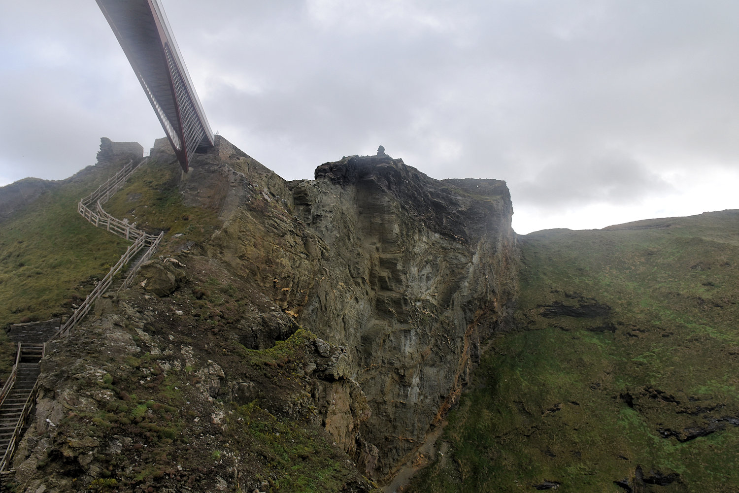
Under the headland which holds most of the castle there is a sea cave.
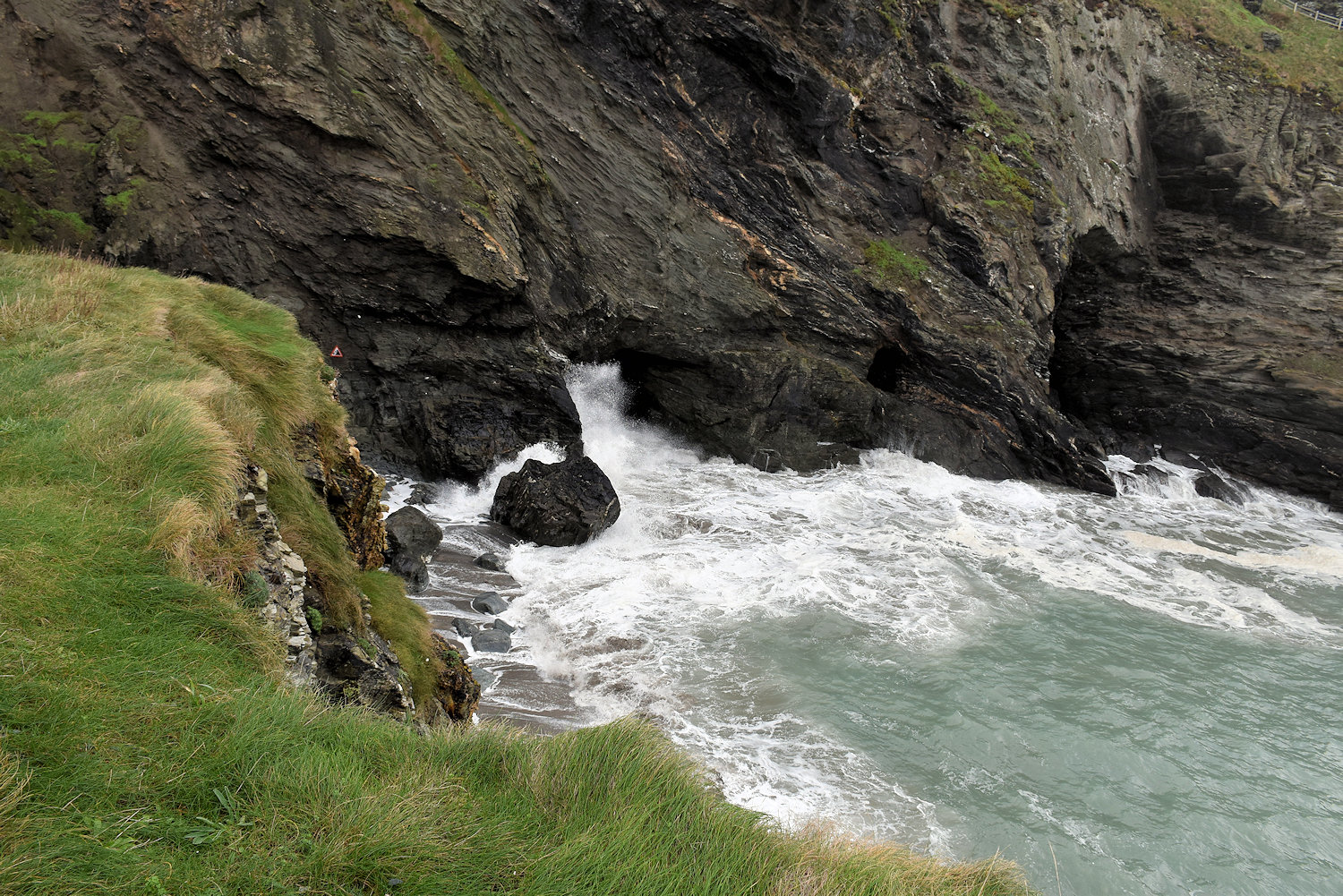
Merlin’s Cave, it is called. For most of the day is is full of water.
Back at Tintagel and its rocky castle…
Under the headland which holds most of the castle there is a sea cave.
Merlin’s Cave, it is called. For most of the day is is full of water.
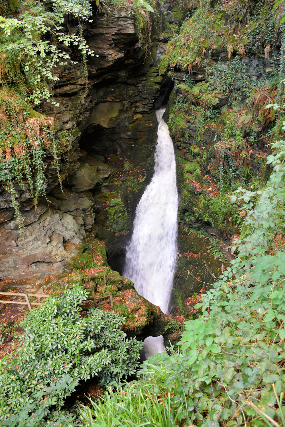
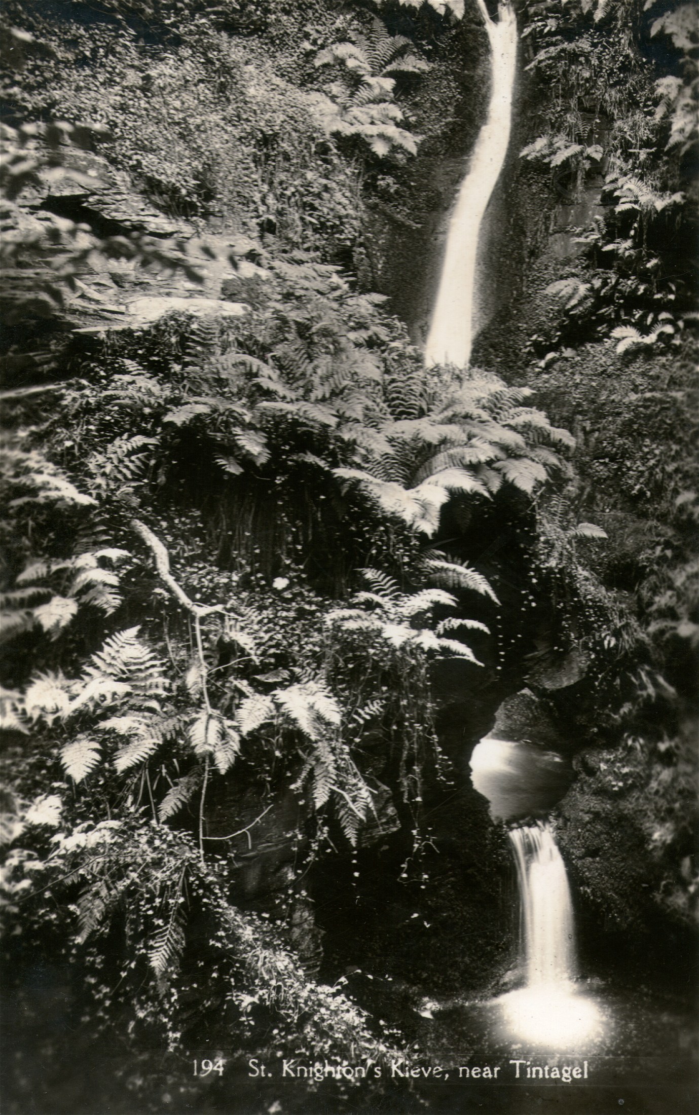
St Nectan’s kieve is revered as a sacred place, where numerous ribbons, crystals, photographs, inscriptions, prayers and other devotions now adorn the foliage and rock walls near the waterfall. You will even find a number of small stacks of flat stones, known as Faerie Stacks, constructed from stones collected from the waters by visitors, marking a special thought or moment in time during their visit, or to commemorate memories and loved ones. . . . It is believed that a building (known as the Hermitage) located at the top of the waterfall belonged to the sixth-century Saint Nectan. The date of the building is uncertain but according to legend, Saint Nectan rang a silver bell in times of stormy weather to warn passing ships of the perils of the rocks at the mouth of Rocky Valley. It is also understood that the ruins of a Christian chapel provide the lower part of the walls of a cottage erected in the 1860s, and extended around 1900.
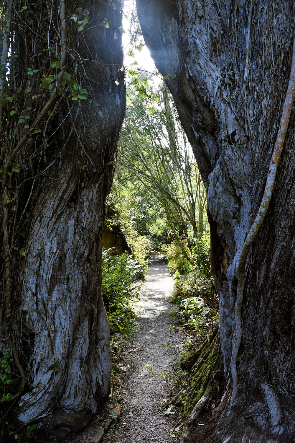
St Nectan’s Glen
The idea that the sixth-century Saint Nectan had his hermitage above the waterfall is myth. According to legend, Nectan rang a silver bell in times of stormy weather to warn shipping of the perils of the rocks at the mouth of the Rocky Valley. Though other legends are also told of Nectan (such as his burial under the riverbed), no evidence exists to substantiate Nectan’s presence here. His home was further north, in what is now Hartland, Devon. The name is first recorded in 1799 as Nathan’s Cave in reference to a local character, either Nathan Williams or Nathan Cock, and the Cornish word Cuva (pronounced keeva) meaning tub.
The legend connecting St Nectan to the falls is the romantic whimsy of the nineteenth century clergyman, Reverend Robert Stephen Hawker who first attributed the falls to the saint in his poem, The Sisters of the Glen in 1846. The “hermitage” written about by Hawker and others was a simple summerhouse and had no connection to any saint. Many of the site’s legends are the result of Hawker’s poetry and the vivid imagination of nineteenth century Trethevy farmer, William Goard who led tour parties to the falls.
Wikipedia.

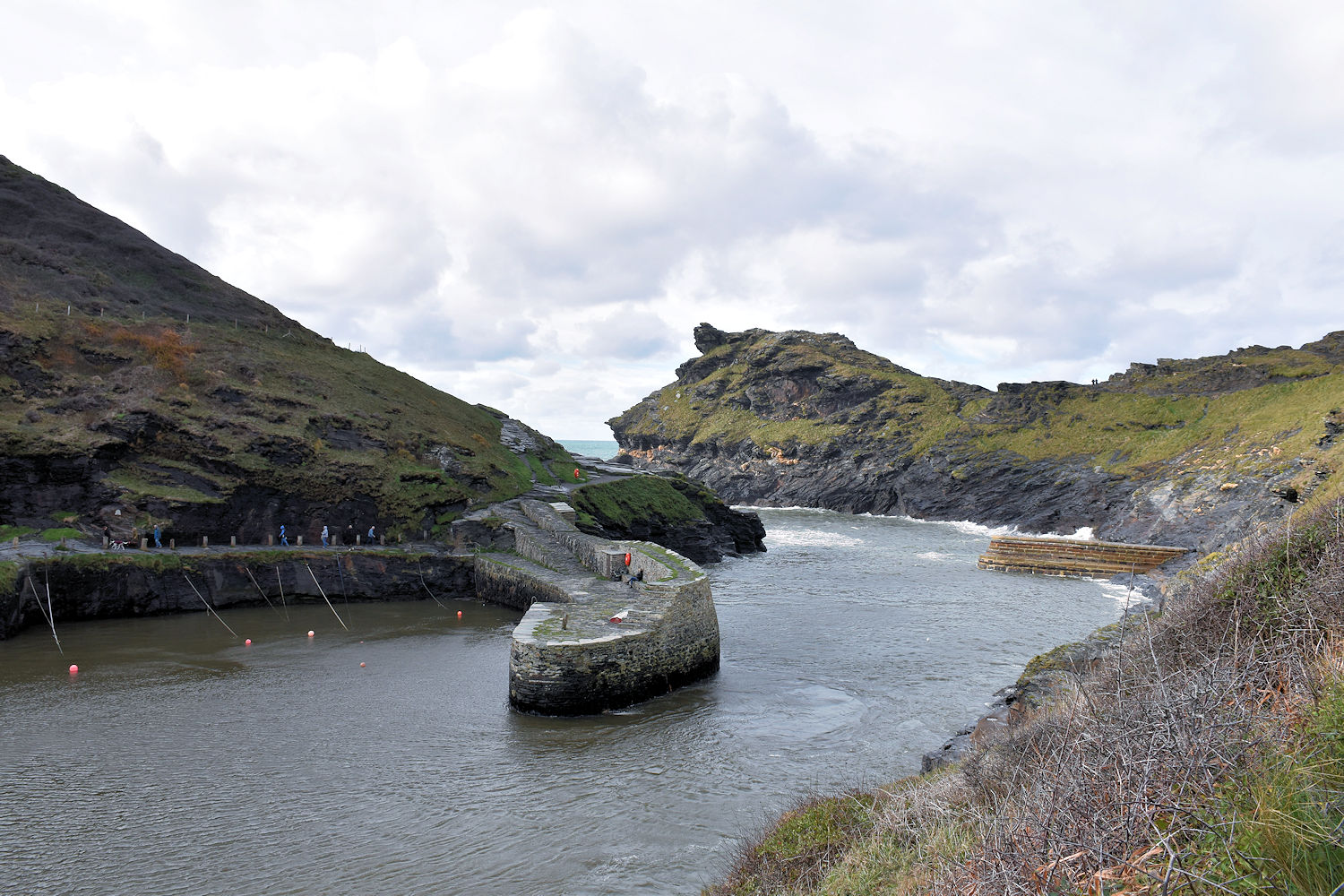
I thought Boscastle was another coastal town with an interesting harbour but instead it’s collection of curious cafes and gift shops with an interesting harbour. I spent a happy hour looking through the shops. (There is a regular town further up the hill.)

Over a century ago Boscastle was a busy, bustling place. It was a commercial port throughout most of the 19th century, for the railway did not reach north Cornwall until 1893. Before that date all heavy goods to and from an area stretching many miles inland had to be carried by sea. More than a dozen ketches and schooners of 30 to 200 tons traded regularly through the little port. In one year alone 200 ships called. Many vessels brought supplies in from South Wales and Bristol but even cargoes of timber direct from Canada came into Boscastle. The tortuous harbour entrance, with the island of Meachard as an extra hazard, meant it was never safe for sailing vessels to enter Boscastle un-assisted. They were therefore towed or ‘hobbled’ in by ‘hobbler’ boats manned by eight oarsmen. Gangs of men on shore took other ropes to keep the ships in the middle of the channel.
National Trust

Postmarked 1906
Publisher: Valentine
This is Tintagel. Do you know the story?”
Back in about 1135 a guy by the name of Geoffrey of Monmouth wrote a book called “The History of the Kings of Britain” and he included a story about a wizard who magicked a king so he could sneak into the castle of the duke he was at war with and have it off with his wife. Then almost a century later, the castle was built by the Earl of Cornwall.
After his death, no one really lived here, other than caretakers. It’s a giant folly. Also over time, bits of it have fallen into the sea.
In 1337 the buildings were in a ruinous state, a part of them joining the work on the mainland to that on the island having fallen into the sea : the drawbridge fell in the sixteenth century.
“The castles of England, their story and structure”, James MacKenzie, 1896

In the background is the village of Tintagel (which was Trevena until according to an English Heritage panel “by about 1900, the village had changed its name . . . making the most of its association with the famous castle”, due to the increased interest in King Arthur in the 19th century.) On the far left is the hotel, unfortunately covered in scaffolding, which was built in 1899 and is an interesting mixture of elaborate late-Victorian decor and worn 1940s furnishings. It’s quirky and comfortable.) The castle is in the middle there, with the mainland section (towards the rear) and the “island” section connected by a bridge.
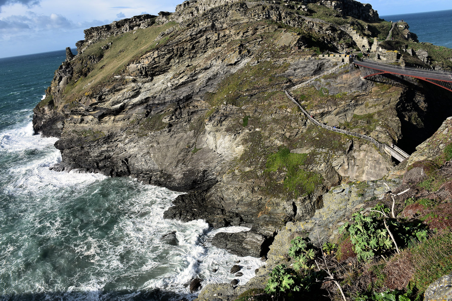
The “island” (you can see the connecting bridge and some of the ruins to the right).
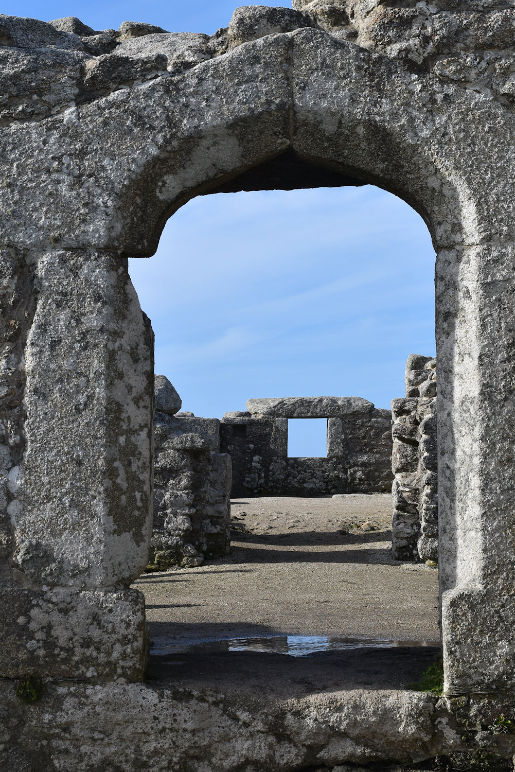
It doesn’t take much imagination to realise there is something on the other side of this gate.

This is Castle Dore, an Iron Age hill fort/defended settlement (the last one 🙁 ) It is interesting for three reasons. First, it is easy to get to. You get off the bus, walk 3 minutes down the road and there’s this well-maintained gate. No trudging along muddy ditches claiming to be paths or clambering up bracken-covered hills.
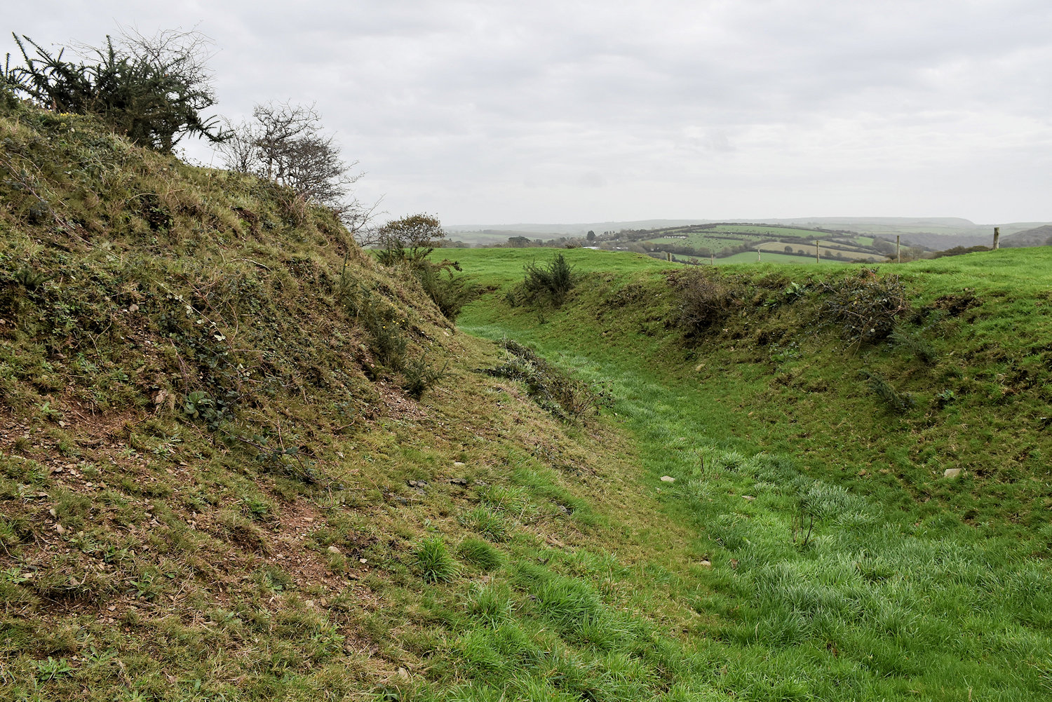
Second, Dore is associated with the story of Tristan & Iseult* as the main residence of King Mark. There is the slight problem of there being no evidence of the site being inhabited beyond the Iron Age, except for a battle during the civil war in the 17th centure.
(*If you’re not familiar with the story: Iseult, an Irish princess comes to Cornwall to marry the king, Mark, but she falls in love with her nephew Tristan. Adventures ensue. Tristan dies tragically. Remember this, it will come up again.)
Now it’s November, I won’t have as much time to edit & upload photos. So it’ll either be less photos or less often.
For today, some pictures of Truro, the administrative centre for Cornwall. It’s a cathedral city with a population of about 20,000.
I’ll start with the cathedral because (as you might notice) it dominates the town. Everywhere you look, there’s the cathedral spires. I walk out of the door of the hotel and there’s the cathedral. OK that might be because it’s next door. It doesn’t look next door on the map but there it is.
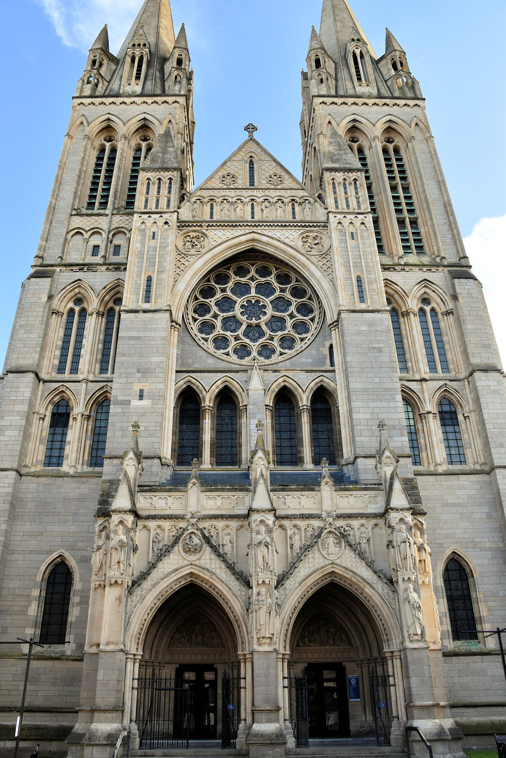
This is the cathedral. Inside it’s pretty much the same as any other cathedral but less interesting. Maybe because it hasn’t had time to develop interestingness. It was only built in 1880. St David’s is older than that.

Except for the reredos. It is a very cool reredos.
Today I walked up to the other other side of St Mary’s. You’ll never guess what I found! OK if you’ve been paying attention you can probably guess.
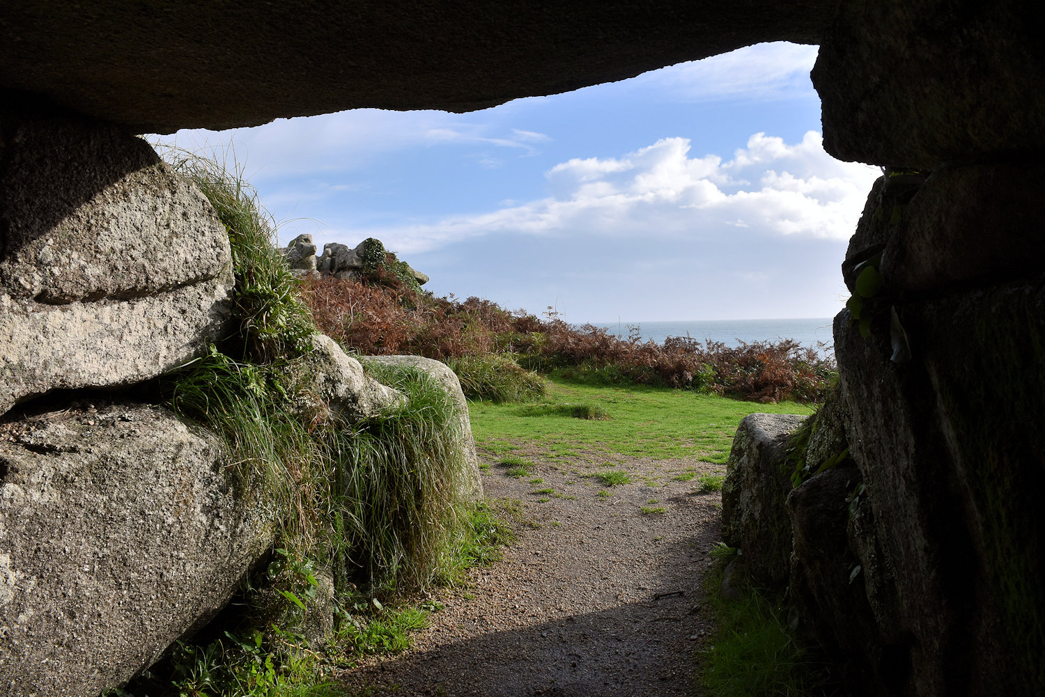
But first, another entrance grave.

From the English Heritage panel:
Innisidgen Upper Burial Chamber
There are as many as 80 prehistoric chambered tombs known on the Isles of Scilly, but this is one of the best preserved. They are generally of the form known as ‘entrance graves’, and date from the Neolithic or the early Bronze Age. The name ‘entrance grave’ may be misleading, since this type of prehistoric monument is unlikely to have been constructed solely for burial purposes. Such ‘graves’ could also have functioned as shrines or as a focus of ceremonies. . . . Although nothing has been found in this chamber, the walls revealed traces of rough clay mortar, suggesting that it was once plastered and possibly even decorated.
Today, I walked across to the other side of St Mary’s and then came back along the coastal path. Some photos!

I like roads with footpaths. I think there needs to be more of them.
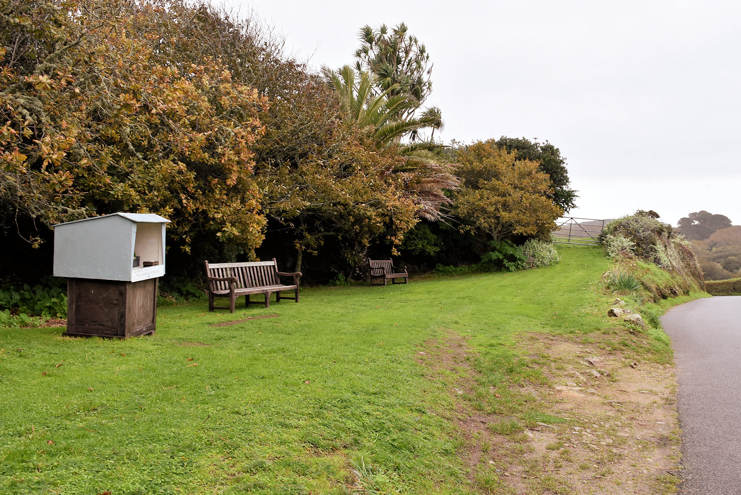
A roadside bookstall.
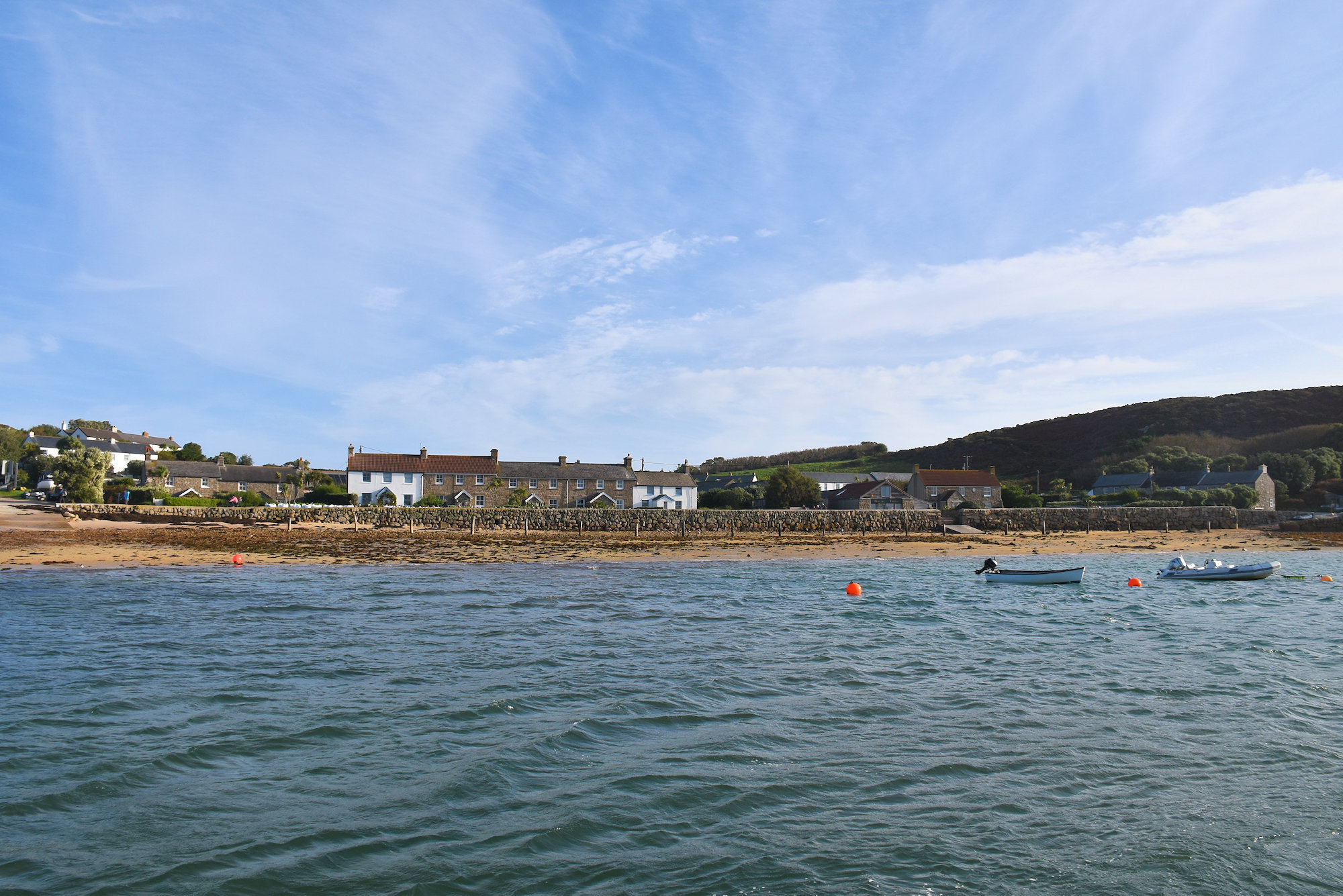
This is Tresco, the second largest island of Scilly. It’s about 3.5 km long so you can easily walk from the north to the south.
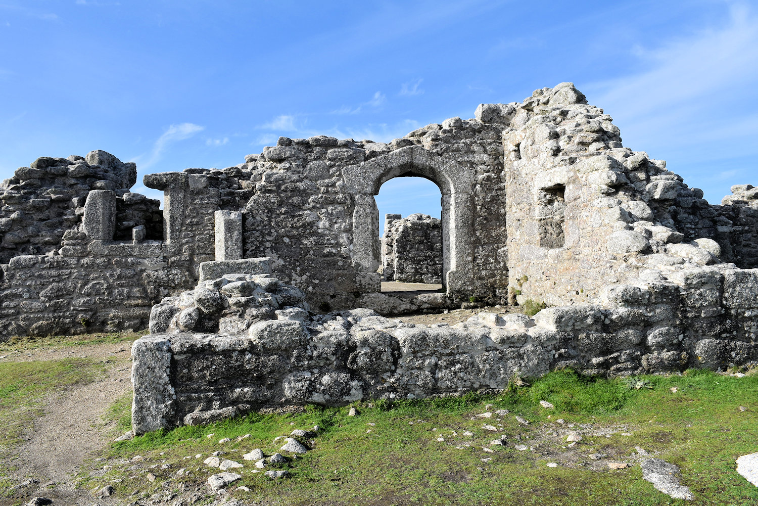
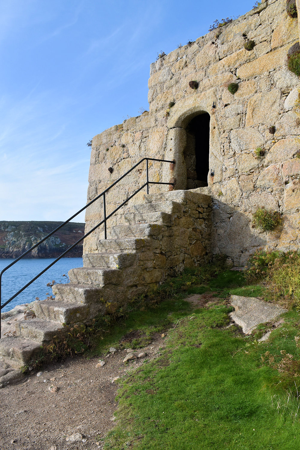
In the north you’ll find King Charles’ Castle, which is neither a castle nor built by, for or in the time of King Charles. It’s a 16th century fort, but it was occupied by Royalist Forces in the Civil War (a century later).

And this is Cromwell’s Castle (also not a castle), built by Parlimentarian forces after they took the island from the Royalists during the Civil War.

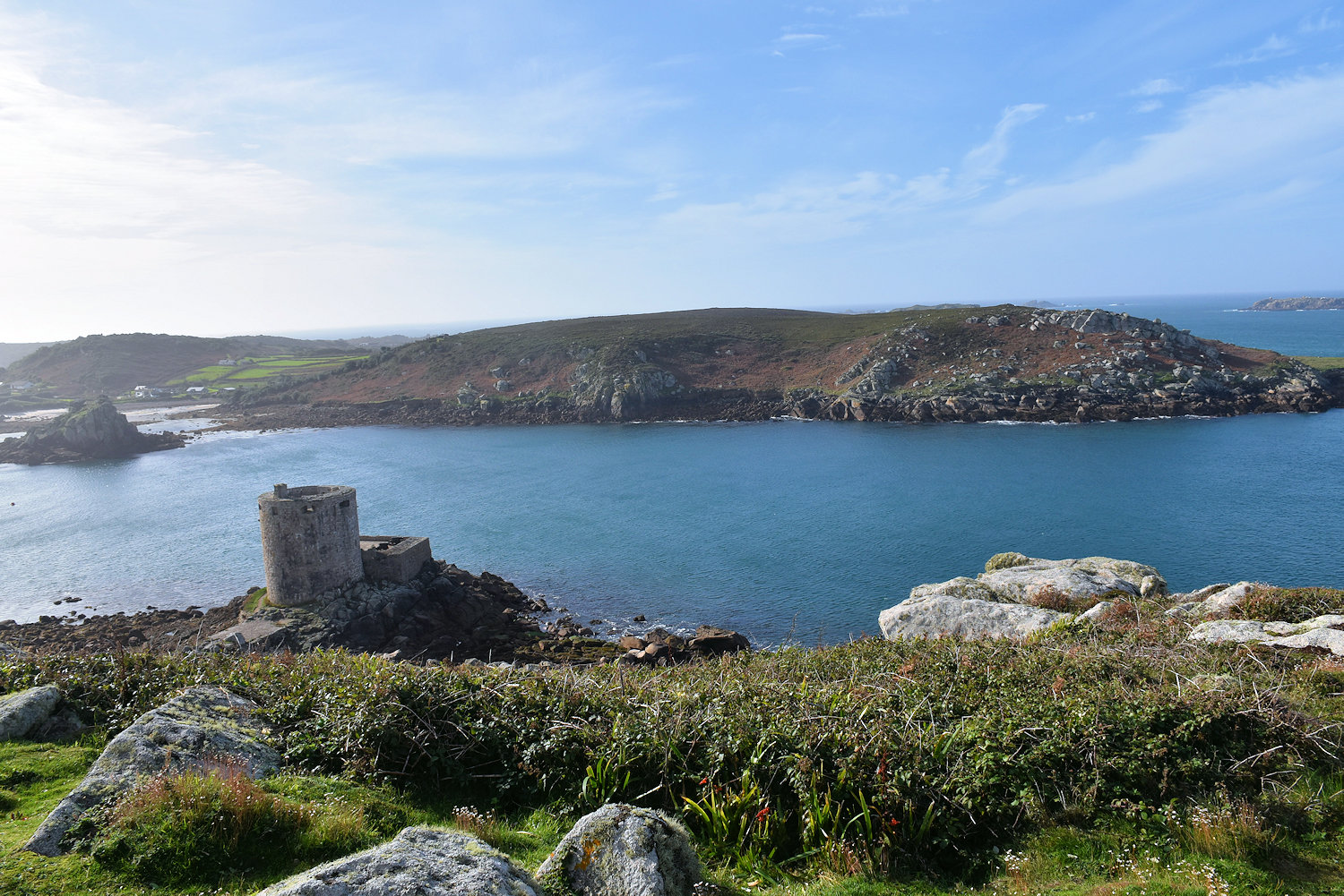
On a clear day you can certainly see the Isles of Scilly from here. Also on a rainy day, if slightly less then. The island to the rear is Bryher.

And that’s Tresco stretching out out before us. The southern tip looks a long way away.

Castle to Castle.

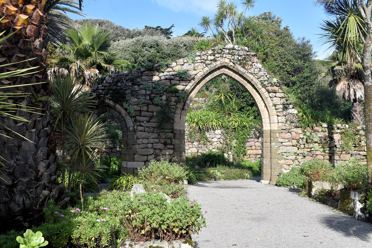
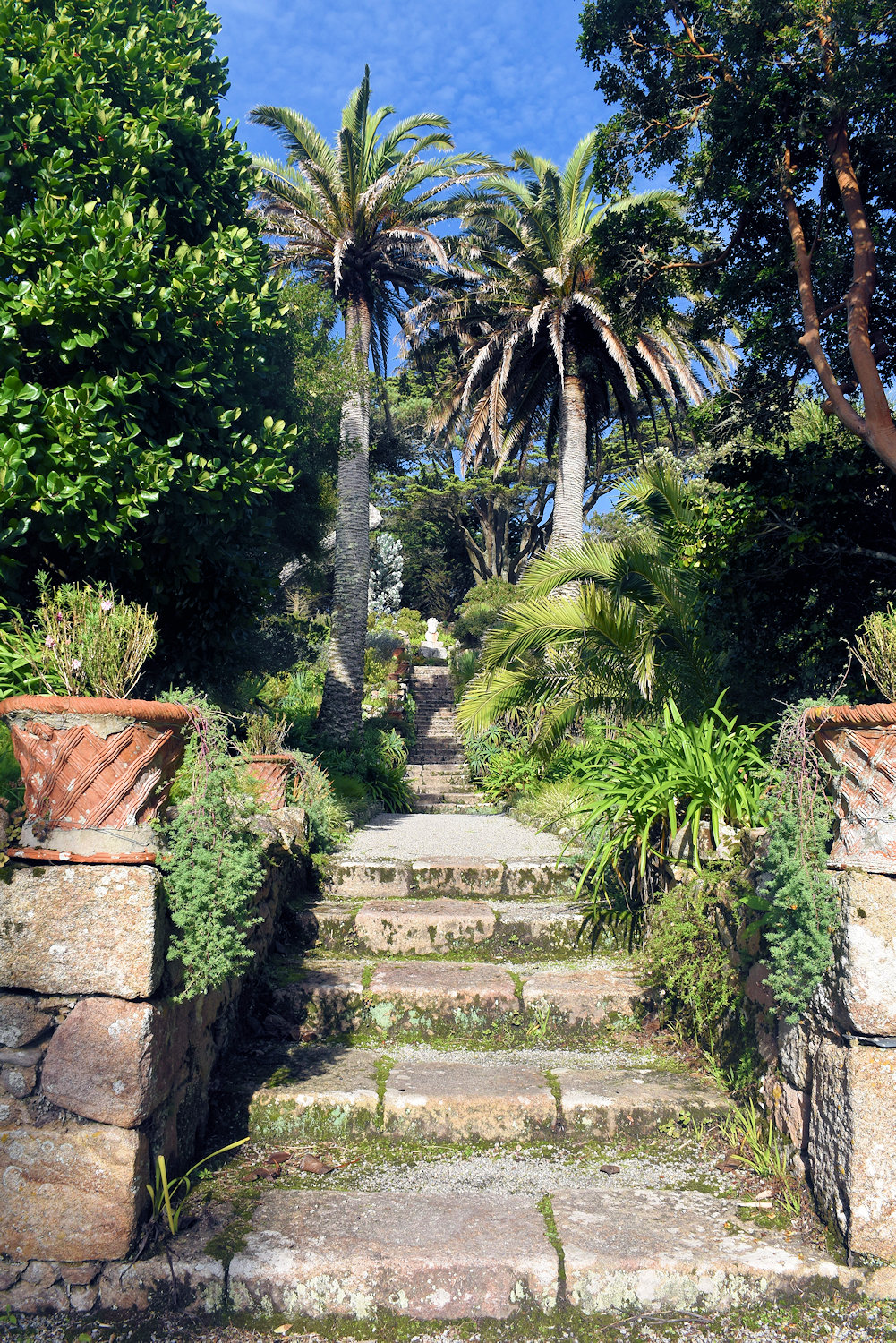
The main settled areas are in the middle of the island. To the south are the Abbey Gardens, the main attraction on the island.
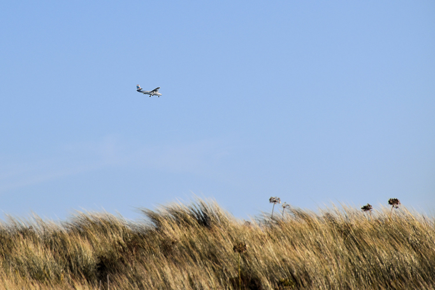
Little plane!

In 1834, Augustus Smith left Hertfordshire and took up residence on the Isles of Scilly as Lord Proprietor and leaseholder of all the islands, choosing Tresco as his home… He selected a site adjacent to St Nicholas Priory – which had fallen into disrepair in the sixteenth century – to build his home. On a rocky outcrop above these ruins, Augustus Smith built his house, which he named Tresco Abbey. In addition to constructing the house, he started almost immediately creating a garden based around the priory ruins. In order to protect his early plantings from the winter gales, he built a series of walls around the garden. The garden then expanded across the south-facing hillside on a series of terraces carved from the granite subsoil.
Tresco Island
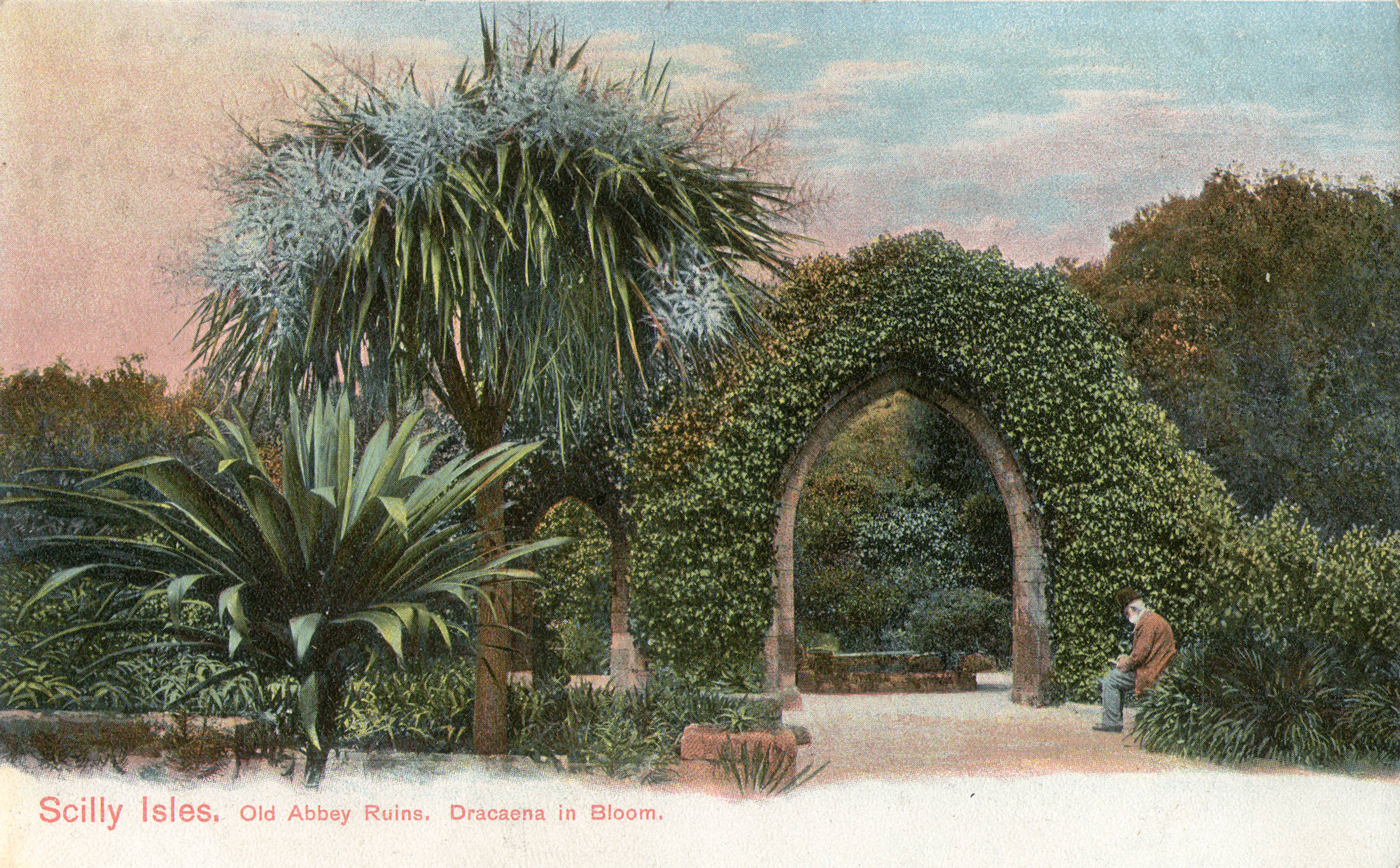
c.1910

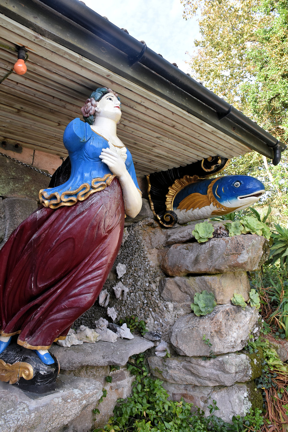
The unique Valhalla collection is situated within Tresco Abbey Garden and contains some 30 figureheads, as well as name boards and other decorative ships’ carvings from the days of sail. Over the years, many ships and lives have been lost on the rocky coasts of the Scillies and it is from shipwrecks – mostly of merchant vessels – that the collection was built up, starting in about 1840, by Augustus Smith of Tresco Abbey, ‘Lord Proprietor’ of the Islands. . . . [M]ost of the figureheads date from the middle and end of the 19th century and come from merchant sailing vessels or early steamships that were wrecked on the Isles of Scilly.
Tresco Island
(Content Warning: contains giant millipedes)
After visiting the Maidens and friends yesterday morning, I was back on the bus by 11 am. It was a sunny day and the Land’s End Coaster that I was on went around to St Ives, where I’d been the day before but it was raining. Drenching, solid rain, and the streets were full of people dragging along bored kids and miserable dogs. It wasn’t much fun. So, with a sunny day and no plans, I thought I’d give it a second chance.
The Land End’s Coaster also stops at Land’s End. My earlier visit there was… brief. Again, it was raining and miserable. I got off one bus and caught the next on in the other direction. I felt it might be a bit better on a sunny day.

Land’s End Landmark this place calls itself. I think it’s trying to be a theme park. They have these “experiences”.

The Aardman one might actually be all right if you’re into Wallace & Gromit or Shaun the Sheep. I’m not and I didn’t feel like handing over 5.50 to find out. There are also some eating places and a very big, possibly mutli-shops, souvenir place. There’s another souvenir shop at the experience exit, with Aardman & pireate souvenirs.